Uncategorized files
Jump to navigation
Jump to search
Showing below up to 500 results in range #501 to #1,000.
View (previous 500 | next 500) (20 | 50 | 100 | 250 | 500)
 Icon GPSFilter.PNG 22 × 22; 371 bytes
 Icon GeneralizeBuildings.PNG 20 × 18; 518 bytes
 Icon GenerateMapPreview.PNG 22 × 22; 542 bytes
 Icon GetObjectsFromCurrentView.PNG 22 × 22; 592 bytes
 Icon ImportMap.PNG 22 × 22; 439 bytes
 Icon IndicateDirectionOfAreaPatternPointOrTextObject.PNG 23 × 23; 4 KB
 Icon InterpolateObjects.PNG 23 × 23; 3 KB
 Icon Join.PNG 23 × 23; 3 KB
 Icon LaserDistance.PNG 23 × 23; 3 KB
 Icon LoadObjectsFromCurrentView.PNG 34 × 22; 886 bytes
 Icon ManageServerBookmarks.PNG 22 × 22; 378 bytes
 Icon Measure.PNG 23 × 23; 4 KB
 Icon Merge.PNG 23 × 23; 4 KB
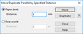
 Icon MoveDuplicatebySpecifiedDistance.PNG 20 × 19; 689 bytes
 Icon MoveParallel.PNG 23 × 23; 4 KB
 Icon New.PNG 23 × 23; 4 KB
 Icon NormalVertex.PNG 23 × 23; 4 KB
 Icon NumericMode.PNG 23 × 23; 3 KB
 Icon ObjectHistory.PNG 22 × 22; 381 bytes
 Icon ObjectInformation.PNG 17 × 20; 414 bytes
 Icon Open.PNG 23 × 23; 4 KB
 Icon OpenGoogleStreetView.PNG 24 × 24; 710 bytes
 Icon OpenRealTimeGPSSettings.PNG 22 × 22; 246 bytes
 Icon Pan.PNG 22 × 22; 4 KB
 Icon PanLocked.PNG 22 × 23; 4 KB
 Icon PauseGPSMeasurement.PNG 22 × 22; 266 bytes
 Icon Print.PNG 23 × 23; 4 KB
 Icon RectangularLineMode.PNG 23 × 23; 4 KB
 Icon RectangularMode.PNG 23 × 23; 4 KB
 Icon Redo.PNG 23 × 23; 4 KB
 Icon RemoveVertex.PNG 23 × 23; 4 KB
 Icon Reshape.PNG 23 × 23; 4 KB
 Icon ReverseObject.PNG 23 × 23; 4 KB
 Icon RightsManagement.PNG 22 × 22; 643 bytes
 Icon RotateEnterAngle.PNG 23 × 23; 3 KB
 Icon RotateObject.PNG 23 × 23; 4 KB
 Icon Save.PNG 23 × 23; 4 KB
 Icon SaveForOfflineWork.PNG 22 × 22; 630 bytes
 Icon SelectAndEditObject.PNG 23 × 23; 3 KB
 Icon SelectDuplicateObjects.PNG 20 × 20; 505 bytes
 Icon SelectLineTextObjectswithLinetooShort.PNG 22 × 21; 435 bytes
 Icon SelectObjectAndEditVertex.PNG 23 × 23; 4 KB
 Icon SelectObjectWithLassoTool.PNG 20 × 19; 540 bytes
 Icon SelectObjectwithLassoTool.PNG 29 × 28; 358 bytes
 Icon SelectSelfIntersectedObjects.PNG 20 × 20; 482 bytes
 Icon Setup.PNG 25 × 26; 398 bytes
 Icon ShowCheckedOutObjects.PNG 22 × 22; 588 bytes
 Icon ShowEntireMap.PNG 22 × 23; 4 KB
 Icon ShowGrid.PNG 23 × 23; 3 KB
 Icon ShowProjectInformation.PNG 22 × 22; 693 bytes
 Icon ShowRulerGuides.PNG 18 × 19; 448 bytes
 Icon ShowRulers.PNG 19 × 19; 471 bytes
 Icon Smooth.PNG 23 × 23; 4 KB
 Icon Snapping.PNG 23 × 23; 4 KB
 Icon StartGPSMeasurement.PNG 22 × 22; 299 bytes
 Icon StopGPSMeasurement.PNG 22 × 22; 251 bytes
 Icon StraightLineMode.PNG 23 × 23; 3 KB
 Icon SymbolStatusManager.PNG 18 × 18; 516 bytes
 Icon Undo.PNG 23 × 23; 3 KB
 Icon ZoomIn.PNG 22 × 23; 4 KB
 Icon ZoomInLocked.PNG 22 × 23; 4 KB
 Icon ZoomOut.PNG 22 × 23; 4 KB
 Icon ZoomOutToPreviousView.PNG 22 × 23; 4 KB
 Icon ZoomToNextView.PNG 23 × 23; 3 KB
 Icon ZoomToPreviousView.PNG 22 × 23; 4 KB
 Icon ZoomtoSelectedObjects.PNG 20 × 20; 553 bytes
 IgnMapJpeg2000 1.png 1,044 × 793; 528 KB
 IgnMapJpeg2000 2.png 351 × 551; 32 KB
 ImportDxfUnsymbolized.png 569 × 487; 25 KB
 ImportFreehandXml.PNG 476 × 276; 12 KB
 ImportMapDialog.PNG 337 × 283; 19 KB
 ImportMaps.PNG 23 × 23; 3 KB
 ImportShapeFile.PNG 707 × 576; 32 KB
 ImportShapeFileOrienteering.PNG 707 × 384; 14 KB
 ImportShapeFileOrienteeringDatabaseTable.PNG 777 × 230; 16 KB
 ImportShapeFileOrienteeringViewTable.PNG 21 × 21; 262 bytes
 ImportShapeText1.png 841 × 561; 78 KB
 ImportShapeText2.png 491 × 387; 22 KB
 ImportShapeText3.png 841 × 561; 79 KB
 IndentFirstLine.PNG 424 × 373; 27 KB
 IndentOtherLines.PNG 397 × 396; 29 KB
 Index1.gif 120 × 120; 10 KB
 Index2.gif 120 × 120; 12 KB
 Index3.gif 120 × 120; 11 KB
 Index4.gif 120 × 120; 10 KB
 IndicateDirectionofPattern.PNG 607 × 377; 13 KB
 Indicate Direction.gif 226 × 170; 450 KB
 Indicate Direction Area.gif 226 × 244; 635 KB
 InflectionPointOfBezierCurve.PNG 275 × 174; 12 KB
 InfluenceDashedNormal.PNG 191 × 74; 3 KB
 InfluenceDashedVertex.PNG 199 × 94; 4 KB
 InfraredImageFalseColors.png 696 × 461; 229 KB
 InfraredImageTrueColors.png 693 × 461; 222 KB
 InsertCourseObject.PNG 482 × 429; 35 KB
 InsertCourseObjectToMultipleCourses.PNG 432 × 666; 40 KB
 InsertGlyphs.PNG 998 × 630; 76 KB
 InsertionLine.PNG 67 × 44; 490 bytes
 Insertvar.gif 107 × 80; 1 KB
 InternalErrorReadXmlLicenseFile.png 486 × 161; 20 KB
 InternalErrorTOcdIsGridZoneValidUnknownGrid.png 436 × 171; 18 KB
 InterpolateLines.png 525 × 163; 24 KB
 InterpolatePoints.png 731 × 113; 16 KB
 Interpolate Line Objects.gif 538 × 462; 3.43 MB
 Interpolate Point Objects.gif 492 × 228; 1.1 MB
 Intersection.PNG 477 × 134; 22 KB
 InvalidExteriorRing.PNG 452 × 184; 8 KB
 Join Merge.gif 382 × 204; 1,018 KB
 Joining Lines.PNG 448 × 501; 14 KB
 Keyline.PNG 658 × 210; 38 KB
 KeylineExample.PNG 1,024 × 124; 126 KB
 Kindhausen.PNG 1,001 × 684; 48 KB
 Kindhausen01.PNG 920 × 686; 180 KB
 Kindhausen02.PNG 1,003 × 709; 504 KB
 Kindhausen03.PNG 997 × 712; 601 KB
 Kindhausen05.PNG 932 × 690; 83 KB
 Kindhausen ConvertImportedLayerToSymbols2.PNG 443 × 419; 26 KB
 Kindhausen CreateContourLines.PNG 631 × 281; 23 KB
 Kindhausen CreateHillShading.PNG 590 × 311; 21 KB
 Kindhausen DEMImport.PNG 514 × 648; 35 KB
 Kindhausen ImportFile.PNG 460 × 474; 30 KB
 LargeSquare.JPG 18 × 21; 8 KB
 LargeSquareCross.png 18 × 21; 337 bytes
 LaserDistanceMeterDataTab.PNG 298 × 313; 12 KB
 LaserDistanceMeterOptionTab.PNG 302 × 320; 13 KB
 LaserRangefinderConnectionTest.png 313 × 361; 13 KB
 LegVariation.PNG 907 × 643; 211 KB
 LegVariationSymbol.PNG 54 × 67; 492 bytes
 LegVariationSymbol2.PNG 82 × 113; 1 KB
 LegVariationTable.PNG 374 × 106; 4 KB
 Legend VegetationHeight.PNG 142 × 182; 3 KB
 LengthenLineTextObjects.png 423 × 170; 9 KB
 LicenseActivation.png 401 × 173; 6 KB
 LicenseManager.png 677 × 450; 19 KB
 LicenseTransferUtility.png 421 × 361; 7 KB
 LidarPointCloudManagerStatisticsExcelErrorMessage.png 469 × 160; 4 KB
 LidarPointCloudManager Classification.png 453 × 431; 38 KB
 LidarPointCloudManager Example.png 1,094 × 519; 199 KB
 LidarPointCloudManager HeightOverGround.png 452 × 429; 179 KB
 LidarPointCloudManager Information.png 313 × 361; 10 KB
 LidarPointCloudManager Intensity.png 453 × 430; 238 KB
 LidarPointCloudManager OrienteeringBaseMapColors.png 598 × 253; 15 KB
 LidarPointCloudManager PointCloud.png 1,010 × 656; 95 KB
 LidarPointCloudManager PointCloud ClassificationLowVegetions.png 448 × 428; 50 KB
 LidarPointCloudManager PointCloud ClassificationMediumVegetions.png 452 × 429; 50 KB
 LidarPointCloudManager PointCloud ClassificationOption.png 413 × 374; 15 KB
 LidarPointCloudManager PointCloud Classification ReturnTypes.png 415 × 101; 2 KB
 LidarPointCloudManager PointCloud ImportOptions.png 434 × 96; 3 KB
 LidarPointCloudManager PointCloud Samples.png 490 × 368; 17 KB
 LidarPointCloudManager PointCloud SymbolBox.png 183 × 62; 1 KB
 LidarPointCloudManager PointCloud Symbols.png 166 × 134; 4 KB
 LidarPointCloudManager Profile.png 1,388 × 598; 59 KB
 LidarPointCloudManager RasterMap.png 962 × 552; 128 KB
 LidarPointCloudManager ShowFrame.png 412 × 392; 35 KB
 LidarPointCloudManager Statistics.png 422 × 169; 4 KB
 LidarPointCloudManager Thresholds.png 865 × 288; 24 KB
 LidarPointCloudManager ThresholdsExcel.png 502 × 217; 14 KB
 LidarPointCloudManager VegetationDensity.png 453 × 427; 81 KB
 LineAppearanceAsOcad10Warning.png 496 × 214; 21 KB
 LineAppearanceOcad10.png 862 × 460; 33 KB
 LineAppearanceOcad11.png 862 × 466; 31 KB
 LineLength.PNG 411 × 369; 10 KB
 LineSpacing.PNG 385 × 420; 22 KB
 LineStyle.PNG 386 × 574; 14 KB
 LineSymbol.JPG 468 × 445; 42 KB
 LineSymbolDistances.PNG 493 × 469; 35 KB
 LineSymbols.PNG 557 × 223; 19 KB
 LineTextSymbol.JPG 412 × 448; 36 KB
 LineTextSymbolGeneral.PNG 433 × 471; 37 KB
 LineTextSymbols.PNG 558 × 176; 11 KB
 LineTool.PNG 28 × 28; 567 bytes
 Line Icon.PNG 27 × 27; 595 bytes
 Linebtn.gif 23 × 22; 887 bytes
 LivePreview.PNG 658 × 210; 19 KB
 LoadObjectsFromSymbolTree.PNG 465 × 391; 26 KB
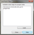 LoadRasterMapDialog.PNG 303 × 318; 29 KB
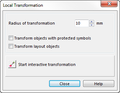 LocalTransformation.png 335 × 261; 12 KB
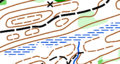
 LocalTransformationExample.png 800 × 309; 118 KB
 MRM01.PNG 1,530 × 1,036; 147 KB
 MRM04.PNG 1,532 × 1,040; 137 KB
 MRM05.PNG 1,083 × 199; 100 KB
 MRM13.PNG 1,579 × 1,075; 170 KB
 MRM14.PNG 1,569 × 1,070; 168 KB
 MRM15.PNG 578 × 225; 38 KB
 MRM16.PNG 841 × 399; 188 KB
 MRM17.PNG 1,026 × 662; 306 KB
 MRM18.PNG 619 × 220; 27 KB
 MRM19.PNG 430 × 222; 19 KB
 MRM20.PNG 1,179 × 797; 656 KB
 MRM21.PNG 678 × 722; 512 KB
 MacOSX1.PNG 1,440 × 900; 1.9 MB
 MacOSX3.PNG 1,440 × 900; 2.31 MB
 MacOSX4.PNG 1,440 × 900; 783 KB
 MacOSX5.PNG 1,440 × 900; 1.78 MB
 MacOSX6.JPG 3,264 × 2,448; 1.77 MB
 MainLineLineSymbolDialog.PNG 475 × 452; 29 KB
 MainSymbolA.PNG 660 × 596; 24 KB
 MajorRoadMiddleLineFrameDashed.PNG 808 × 91; 7 KB
 ManageBackgroundMap.PNG 994 × 343; 25 KB
 ManageBackgroundMapEncryptedIcon.png 874 × 189; 23 KB
 ManageBackgroundMapEncryptedInfo.png 327 × 255; 17 KB
 ManageBackgroundMapInfo.png 356 × 235; 18 KB
 ManageBackgroundMapInfoOcad.png 366 × 271; 13 KB
 ManageBookmarks.PNG 263 × 353; 18 KB
 ManageProjectUsers.png 579 × 323; 32 KB
 ManageServerBookmarks.PNG 23 × 23; 3 KB
 MapInformation.png 769 × 653; 35 KB
 MapLayout.PNG 1,581 × 1,276; 243 KB
 Mark Color.PNG 206 × 31; 834 bytes
 Mark Color Drawing.PNG 380 × 280; 3 KB
 Mark Color GpsCursor.PNG 41 × 43; 255 bytes
 Mark Color HighContrast.PNG 437 × 179; 3 KB
 Mark Size.PNG 671 × 259; 14 KB
 Markedroute.gif 24 × 24; 890 bytes
 Mas40px.png 40 × 20; 759 bytes
 MaximumLengthHelp.PNG 501 × 356; 21 KB
 Menu.JPG 860 × 16; 16 KB
 Merge.PNG 447 × 218; 14 KB
 MergeContourLinesBySelectedSymbols.png 303 × 182; 12 KB
 MergeObjectsByRecord.PNG 1,091 × 305; 29 KB
 MessageBoxInfraredImage.png 441 × 171; 15 KB
 MinimumBezier.PNG 212 × 88; 1 KB
 MinorRoad.png 806 × 96; 6 KB
 MinorRoadNormal.PNG 804 × 164; 8 KB
 MinorRoadNormal DoubleLine.PNG 514 × 491; 41 KB
 MinorRoad DoubleLine.PNG 472 × 452; 26 KB
 MinorRoad Framing.PNG 506 × 473; 34 KB
 MinorRoad Intersection.PNG 547 × 290; 5 KB
 MinorRoad Overpass.PNG 551 × 304; 6 KB
 Minroad.gif 289 × 19; 1 KB
 Mirror.PNG 324 × 208; 11 KB
 MirrorExample.PNG 1,104 × 300; 96 KB
 Mirror Duplicate.gif 494 × 352; 2.29 MB
 MobileToolbar.png 576 × 50; 3 KB
 Motorway.PNG 775 × 78; 7 KB
 Motorway.gif 288 × 26; 1 KB
 Motorway Distances.PNG 471 × 450; 25 KB
 Motorway DoubleLine.PNG 484 × 461; 20 KB
 Motorway Framing.PNG 511 × 485; 35 KB
 Motorway Intersection.PNG 366 × 157; 2 KB
 Motorway MainLine.PNG 472 × 448; 27 KB
 Motorway Overpass.PNG 357 × 169; 3 KB
 MousePointerMove.PNG 27 × 26; 267 bytes
 Move.PNG 323 × 188; 11 KB
 Move.gif 494 × 352; 2.4 MB
 MoveAndDuplicate.PNG 376 × 322; 20 KB
 MoveDown.png 19 × 19; 714 bytes
 MoveParallelWithDistance.PNG 515 × 210; 10 KB
 MoveParallelWithDistance DialogBox.PNG 364 × 152; 5 KB
 MoveSegmentBuildingEdge.gif 432 × 420; 44 KB
 MoveSegmentVegetationBorderline.gif 384 × 364; 35 KB
 MoveToDialog.PNG 344 × 178; 16 KB
 MoveUp.png 19 × 19; 690 bytes
 Move Duplicate.gif 494 × 352; 2.76 MB
 Move Parallel.gif 326 × 196; 952 KB
 Move Parallel Distance.gif 494 × 352; 3.17 MB
 Move Parallel Distance Duplicate.gif 494 × 352; 2.58 MB
 Move segment building edge.gif 432 × 420; 44 KB
 MultiRepresentationManager.png 628 × 407; 26 KB
 MultiRepresentationManagerSettings.png 628 × 407; 23 KB
 MultipleRepresentationCopyToRepresentationContextMenu.png 409 × 292; 17 KB
 MultipleRepresentationManagerWithProjectsAndChanges.png 1,405 × 481; 99 KB
 MultipleRepresentationOriginalMap.png 975 × 660; 76 KB
 MultipleRepresentationRepresentationGermanTitle.png 623 × 389; 33 KB
 MultipleRepresentationRepresentationStyleChange.png 532 × 339; 22 KB
 NationalPark.PNG 627 × 98; 4 KB
 NationalPark DoubleLine.PNG 498 × 476; 29 KB
 NationalPark Framing.PNG 466 × 446; 21 KB
 NationalPark MainLine.PNG 468 × 444; 27 KB
 NewAreaSymbolDialog.PNG 370 × 290; 23 KB
 NewConnectionDialog.PNG 511 × 640; 44 KB
 NewFile.PNG 421 × 677; 19 KB
 NewLineSymbolDialog.PNG 366 × 287; 23 KB
 NewLineTextSymbolDialog.PNG 383 × 302; 27 KB
 NewMapWizard Location.png 850 × 821; 250 KB
 NewMapWizard OsmImport.png 838 × 293; 8 KB
 NewMapWizard OsmImport Map.png 1,157 × 775; 275 KB
 NewMapWizard SymbolSet.png 837 × 485; 20 KB
 NewPoint.JPG 457 × 214; 23 KB
 NewPointSymbol.JPG 1,278 × 877; 182 KB
 NewPointSymbol.PNG 1,158 × 612; 29 KB
 NewRectangleSymbolDialog.PNG 379 × 301; 26 KB
 NewSymbol.JPG 340 × 260; 21 KB
 NewTextSymbolDialog.PNG 391 × 321; 24 KB
 NonGeoreferencedRasterMap.png 301 × 218; 5 KB
 NormalCorner.PNG 190 × 92; 2 KB
 NormalCornerVertex.JPG 160 × 39; 8 KB
 NormalDashCornerVertexRound.PNG 521 × 116; 12 KB
 NormalDashCornerVetex.PNG 260 × 83; 6 KB
 Normalmap.PNG 1,054 × 635; 178 KB
 NumberOfObjects.JPG 278 × 126; 16 KB
 NumberOfStartHelp.PNG 628 × 420; 29 KB
 NumberingHelp.PNG 661 × 319; 27 KB
 NumericKeypadToolbar.png 190 × 50; 2 KB
 NumericToolbar.JPG 426 × 31; 11 KB
 Numerical Drawing Mode.gif 826 × 582; 6.19 MB
 OCAD11Beta.png 610 × 390; 29 KB
 OCAD11 Offline Wiki Header.jpg 709 × 147; 91 KB
 OCAD11 Wiki Header.jpg 709 × 227; 101 KB
 OCAD12 Wiki Header.png 440 × 274; 8 KB
 OCADPreferencesScreenGrid.PNG 371 × 92; 3 KB
 OIMExportAssistant1.PNG 1,585 × 1,272; 293 KB
 OIMExportAssistantPOIDatafields.png 368 × 315; 23 KB
 OIMExportAssistantPOIIconSettings.png 346 × 344; 19 KB
 OIMExportAssistantPOIOverview.png 652 × 525; 23 KB
 OIMExportAssistantPOISelector.PNG 346 × 344; 24 KB
 OIMExportAssistantPOIVectorSettings.png 346 × 344; 18 KB
 OIMExportAssistantZoomLevels.PNG 652 × 525; 29 KB
 ObjectHistory.PNG 439 × 341; 50 KB
 ObjectInformation.png 320 × 525; 23 KB
 ObjectMeasure.png 386 × 229; 18 KB
 Ocad12TrialErrorMessageCodeSigning1.png 721 × 49; 5 KB
 Ocad12TrialErrorMessageCodeSigning2.png 845 × 241; 24 KB
 Ocad12TrialErrorMessageCodeSigning3.png 414 × 315; 23 KB
 OcadMapOnGarminOregon.jpg 801 × 438; 44 KB
 OcadUpdater.png 554 × 494; 25 KB
 Oim2ndLayerBasisFunctions.png 705 × 397; 30 KB
 Oim2ndLayerFolders.png 246 × 175; 6 KB
 Oim2ndLayerInitBasemap.png 756 × 267; 26 KB
 Oim export resolution.GIF 678 × 486; 103 KB
 On.PNG 719 × 182; 13 KB
 OnlineMapServices.png 1,117 × 639; 1.27 MB
 OnlineMapServicesBackgroundMap.png 871 × 612; 606 KB
 OnlineMapServicesResolution.png 301 × 218; 5 KB
 OnlyObject.JPG 134 × 113; 10 KB
 OnlyObject.PNG 151 × 167; 14 KB
 Opacity.PNG 381 × 76; 2 KB
 OpenPaintTool.PNG 28 × 28; 950 bytes
 OptimizationResult.png 459 × 324; 25 KB
 OptimizeRepair.png 359 × 241; 18 KB
 Order BackgroundMap.png 3,230 × 1,629; 560 KB
 Order ImageObjects.PNG 3,230 × 1,629; 562 KB
 Order Layout.png 3,230 × 1,629; 576 KB
 Order SymbolizedAndGraphicObjects.PNG 3,230 × 1,629; 577 KB
 Order UnsymbolisizedObjects.PNG 3,230 × 1,629; 581 KB
 OrientationToNorth.PNG 694 × 421; 25 KB
 OrienteeringStandard.PNG 120 × 45; 2 KB
 OriginalMap.png 476 × 350; 178 KB
 OsmExport.jpg 321 × 506; 67 KB
 OsmExport.png 521 × 443; 19 KB
 Osm CoordinateSystem.PNG 547 × 455; 24 KB
 Osm ImportOSMXml.PNG 468 × 248; 16 KB
 Osm MapOffset.PNG 431 × 385; 21 KB
 Osm export.PNG 325 × 482; 19 KB
 OutDashed Distances.PNG 493 × 476; 24 KB
 OutDashed DoubleLine.PNG 493 × 467; 26 KB
 OutDashed Framing.PNG 484 × 467; 35 KB
 OutDashed MainLine.PNG 480 × 450; 26 KB
 OutermostInflectionPointOfABezierCurve.PNG 249 × 113; 9 KB
 Overprint.PNG 812 × 409; 23 KB
 Paragraph.PNG 483 × 567; 43 KB
 PasteTool.PNG 28 × 28; 630 bytes
 PenTool.PNG 28 × 28; 577 bytes
 PickColorTool.PNG 28 × 28; 714 bytes
 PlaceTextUsingATextFrame.PNG 385 × 116; 13 KB
 PlaceTextUsingATextSymbol.PNG 381 × 103; 7 KB
 Place Text Object.gif 826 × 582; 12.68 MB
 PointSymbol.JPG 21 × 27; 8 KB
 PointSymbolVectorData1.PNG 867 × 657; 95 KB
 PointSymbolVectorData2.PNG 882 × 664; 56 KB
 PointSymbolVectorData3.PNG 821 × 248; 16 KB
 PointSymbolVectorData4.PNG 419 × 392; 28 KB
 PointSymbolVectorData5.PNG 312 × 269; 8 KB
 PointSymbolVectorData6.PNG 140 × 138; 1 KB
 PointSymbols.PNG 901 × 192; 11 KB
 Point Symbol.gif 826 × 582; 7.64 MB
 PointedEnds.PNG 442 × 401; 13 KB
 PointedLine.PNG 625 × 84; 3 KB
 PointedLine MainLine.PNG 511 × 502; 42 KB
 Pointedline.gif 272 × 19; 962 bytes
 Polyline.PNG 431 × 198; 3 KB
 PolylinetoCurve.PNG 447 × 200; 16 KB
 PowerLine.PNG 625 × 73; 4 KB
 PowerLine DoubleLine.PNG 516 × 485; 40 KB
 PowerLine SymbolEditor.PNG 398 × 398; 9 KB
 PowerLine Symbols.PNG 475 × 448; 25 KB
 Powerline.gif 289 × 27; 1 KB
 Print.PNG 260 × 590; 22 KB
 PrintControlDescriptionPdf.png 301 × 501; 9 KB
 PrintControlDescriptionPdfReader.png 566 × 330; 65 KB
 PrintControlDescriptions.PNG 358 × 676; 38 KB
 PrintCoursesOnly.PNG 684 × 409; 40 KB
 PrintFrame.png 1,152 × 648; 131 KB
 PrintGrid.PNG 818 × 422; 137 KB
 PrintIntensity.PNG 822 × 431; 118 KB
 PrintLineWidth.PNG 816 × 419; 116 KB
 PrintRelayDialog.PNG 417 × 408; 23 KB
 Pro40px.PNG 40 × 20; 652 bytes
 Pro75.PNG 40 × 40; 553 bytes
 Professional.PNG 120 × 45; 1 KB
 ProfileExample.PNG 1,065 × 481; 44 KB
 ProfileRoute.PNG 511 × 358; 213 KB
 Properties.PNG 27 × 27; 430 bytes
 PunchingUnitIDs.PNG 720 × 424; 41 KB
 RailwayDistances.png 449 × 426; 13 KB
 RailwayDoubleLine.png 449 × 426; 14 KB
 RailwayFraming.png 449 × 426; 11 KB
 RailwayMainLine.png 449 × 426; 15 KB
 RasterMapAssignPermissions.PNG 543 × 361; 52 KB
 Raster bsp.png 410 × 346; 3 KB
 Raster bsp2.png 410 × 380; 5 KB
 RealTimeGPS.PNG 839 × 133; 24 KB
 RealTimeGPSBox.PNG 150 × 168; 6 KB
 RealTimeGpsSettings.png 551 × 470; 32 KB
 RectangleGrid.PNG 263 × 275; 6 KB
 RectangleSymbol.JPG 483 × 465; 43 KB
 RectangleSymbolDialog.PNG 505 × 490; 44 KB
 RectangleSymbolWithLineStyle.PNG 455 × 513; 28 KB
 RectangleSymbols.PNG 398 × 159; 5 KB
 RectangleTool.PNG 28 × 28; 428 bytes
 Rectangle LineStyle.PNG 932 × 428; 15 KB
 RectifyObjects.PNG 498 × 304; 11 KB
 RedrawBackgroundAutomatically.PNG 421 × 331; 15 KB
 RegistryEditor1.PNG 571 × 184; 21 KB
 RegistryEditor2.PNG 573 × 137; 20 KB
 RegistryEditor3.PNG 572 × 140; 42 KB
 RegistryOcadUpdater.png 681 × 321; 44 KB
 RelayExampleCourse.PNG 475 × 328; 93 KB
 Relink.PNG 421 × 129; 12 KB
 ReloadSelection.PNG 788 × 375; 60 KB
 RemoveUnderandOvershoots.PNG 567 × 312; 16 KB
 Rename.PNG 461 × 111; 9 KB
 Reshape.PNG 658 × 210; 27 KB
 Reshape.gif 592 × 326; 2.31 MB
 ReshapeContinue.png 450 × 171; 12 KB
 Reverse.gif 288 × 274; 928 KB
 ReverseObjectExample.PNG 906 × 387; 38 KB
 Rightclick.png 514 × 376; 30 KB
 RightsManagementDialog.PNG 711 × 318; 49 KB
 Rotate.PNG 343 × 188; 11 KB
 RotateClockwiseTool.PNG 28 × 28; 539 bytes
 RotateCounterclockwiseTool.PNG 28 × 28; 544 bytes
 RotateMapExample.PNG 1,104 × 278; 102 KB
 RotateSymbol.JPG 22 × 33; 8 KB
 Rotate Object.gif 326 × 164; 701 KB
 Rotate Object Angle.gif 544 × 418; 3.02 MB
 Routing1.png 603 × 301; 33 KB
 Routing2.png 785 × 233; 20 KB
 Routing3.png 248 × 56; 2 KB
 Routing4.png 982 × 667; 275 KB
 Routing5.png 1,299 × 820; 708 KB
 Routing6.png 603 × 301; 32 KB
 Routing7.png 945 × 635; 305 KB
 Routing8.png 25 × 25; 463 bytes
 Routing9.png 817 × 660; 74 KB
 Rubbersheeting.PNG 798 × 804; 809 KB
 Rubbersheeting2.PNG 789 × 808; 795 KB
 Rubbersheeting3.PNG 817 × 816; 1.11 MB
 RulerGuideA4.PNG 515 × 360; 16 KB
 RulerGuideDialogBox.png 428 × 458; 23 KB
 RulerHowTo.PNG 300 × 210; 19 KB
 SOSI import.png 765 × 471; 51 KB
 SOSI import 2.png 359 × 376; 17 KB
 SOSI import 3.png 867 × 673; 72 KB
 SaveForOfflineWork.PNG 23 × 23; 3 KB
 SaveSelection.PNG 435 × 109; 14 KB
 ScaleSelectedSymbolElement.PNG 243 × 251; 9 KB
 ScanDialog.png 543 × 423; 20 KB
 SchweizerWanderwege1.PNG 1,437 × 867; 329 KB
 SchweizerWanderwege2.PNG 940 × 687; 118 KB
 SchweizerWanderwege3.PNG 875 × 599; 642 KB
 SchweizerWanderwege4.PNG 1,046 × 693; 1.17 MB
 SchweizerWanderwege5.PNG 1,177 × 596; 41 KB
 SchweizerWanderwegeLogo.PNG 800 × 372; 12 KB
 Scmapexchange.gif 253 × 32; 1 KB
 ScreenGrid.png 942 × 743; 53 KB
 SecondarySymbol.PNG 644 × 284; 13 KB
 SecondaryTable.PNG 698 × 259; 25 KB
 SelectAndEditAVertexSelection.PNG 474 × 222; 6 KB
 SelectByLassoExample.png 800 × 318; 34 KB
 SelectDatabaseObject.PNG 551 × 502; 23 KB
 SelectObjectbyDate.png 439 × 240; 13 KB
 SelectObjectbyDateSort.png 1,000 × 172; 28 KB
 SelectObjectsWithInvalidGeometry.PNG 820 × 472; 49 KB
 SelectTool.PNG 28 × 28; 495 bytes
 Select Multiple Objects.gif 224 × 314; 787 KB
 Select Object Lasso.gif 226 × 236; 1.22 MB
 SelectandEditObjectExample.PNG 483 × 178; 5 KB
 SelectandEditObjectSelection.PNG 483 × 178; 5 KB
 SelectbyPropertyDialogBox.PNG 807 × 206; 15 KB
 SelectbyPropertyDialogBox example.PNG 809 × 209; 16 KB
 SelectbySymbolDialog.PNG 415 × 279; 21 KB
 SelectedArea.PNG 301 × 161; 20 KB
 SelectedObjetWithObjectFrame.PNG 144 × 145; 7 KB
 SendFileByEmail.PNG 601 × 502; 38 KB
 ServerClientToolbar.PNG 435 × 34; 8 KB
 ServerClient ChangeHistory.PNG 565 × 354; 11 KB
 ServerClient CreateNewProject.PNG 467 × 646; 43 KB
 ServerClient GeneratePreview.PNG 219 × 121; 7 KB
 ServerClient NewConnection.png 677 × 654; 70 KB
 ServerClient ServerShowsCheckedOut.PNG 642 × 399; 18 KB
 ServerClient ViewObjectInDB.PNG 538 × 352; 53 KB
 ServiceUpdate.gif 961 × 766; 45 KB
 SetScaleAnd CoordinateSystem.PNG 627 × 546; 40 KB
 Setup.JPG 28 × 31; 8 KB
 SetupActivation.png 654 × 573; 41 KB
 SetupInstallation.png 513 × 398; 20 KB
 SetupLanguage.png 513 × 398; 26 KB
 SetupLanguage en.gif 503 × 392; 14 KB
 SetupOnePage.PNG 407 × 212; 18 KB


