Unused files
Jump to navigation
Jump to search
The following files exist but are not embedded in any page. Please note that other web sites may link to a file with a direct URL, and so may still be listed here despite being in active use.
Showing below up to 346 results in range #21 to #366.
View (previous 500 | next 500) (20 | 50 | 100 | 250 | 500)
 Powerline.gif 289 × 27; 1 KB
 NormalCornerVertex.JPG 160 × 39; 8 KB
 NewPointSymbol.JPG 1,278 × 877; 182 KB
 LineSymbol.JPG 468 × 445; 42 KB
 AreaSymbol.JPG 388 × 353; 33 KB
 TextSymbol.JPG 444 × 532; 39 KB
 LineTextSymbol.JPG 412 × 448; 36 KB
 RectangleSymbol.JPG 483 × 465; 43 KB
 AllObjects.JPG 133 × 114; 11 KB
 OnlyObject.JPG 134 × 113; 10 KB
 Dotted.gif 289 × 13; 1,013 bytes
 Index1.gif 120 × 120; 10 KB
 Index2.gif 120 × 120; 12 KB
 Index3.gif 120 × 120; 11 KB
 Index4.gif 120 × 120; 10 KB
 Colors.jpg 992 × 709; 107 KB
 DrawAStraightLine.PNG 612 × 126; 14 KB
 DrawObjectsUsingDifferentDrawingModes.PNG 658 × 210; 21 KB
 EditVertex.PNG 192 × 140; 6 KB
 NormalDashCornerVetex.PNG 260 × 83; 6 KB
 NormalCorner.PNG 190 × 92; 2 KB
 BackgroundMap.JPG 2,478 × 446; 147 KB
 AllObjects.PNG 151 × 169; 13 KB
 OnlyObject.PNG 151 × 167; 14 KB
 DashedNormalVertex.PNG 117 × 98; 3 KB
 DashedCornerVertex.PNG 118 × 135; 4 KB
 InfluenceDashedNormal.PNG 191 × 74; 3 KB
 InfluenceDashedVertex.PNG 199 × 94; 4 KB
 Avenue.png 750 × 155; 20 KB
 OriginalMap.png 476 × 350; 178 KB
 CreateADesiredSector.png 476 × 350; 59 KB
 CreateAHole.png 476 × 350; 159 KB
 DeleteSelectedObjectsInACertainArea.png 476 × 350; 170 KB
 Reshape.PNG 658 × 210; 27 KB
 ContourLines.PNG 519 × 559; 41 KB
 DashedLineWithDots SymbolEditor.PNG 403 × 400; 10 KB
 MinorRoad DoubleLine.PNG 472 × 452; 26 KB
 DashedFraming MainLine.PNG 476 × 464; 26 KB
 DashedFraming Distances.PNG 513 × 468; 25 KB
 DashedFraming DoubleLine.PNG 513 × 479; 26 KB
 DashedFraming Framing.PNG 484 × 468; 20 KB
 NationalPark Framing.PNG 466 × 446; 21 KB
 MinorRoad.png 806 × 96; 6 KB
 Legend VegetationHeight.PNG 142 × 182; 3 KB
 Osm export.PNG 325 × 482; 19 KB
 GIS ImportShapeFiles.PNG 463 × 713; 40 KB
 GIS AddTextsByRecords.PNG 505 × 403; 25 KB
 GIS AssignSymbolByRecords.PNG 442 × 422; 27 KB
 GIS Symbolsset.PNG 1,073 × 808; 60 KB
 OsmExport.jpg 321 × 506; 67 KB
 Symbolset TLM.gif 935 × 768; 76 KB
 WMS4.png 1,600 × 801; 3.13 MB
 WMS2.png 832 × 621; 52 KB
 WMS1.png 832 × 423; 25 KB
 WMS3.png 968 × 171; 61 KB
 Insertvar.gif 107 × 80; 1 KB
 ConvertToGraphicObject.PNG 768 × 344; 63 KB
 Draftmodeslider1.gif 135 × 31; 1 KB
 EditFunctionsToolbar.PNG 506 × 29; 3 KB
 ServerClient NewConnection.png 677 × 654; 70 KB
 ServerClient CreateNewProject.PNG 467 × 646; 43 KB
 ServerClient ViewObjectInDB.PNG 538 × 352; 53 KB
 ServerClient ServerShowsCheckedOut.PNG 642 × 399; 18 KB
 ServerClient GeneratePreview.PNG 219 × 121; 7 KB
 ServerClient ChangeHistory.PNG 565 × 354; 11 KB
 ServerClientToolbar.PNG 435 × 34; 8 KB
 ConnectDisconnect.PNG 23 × 23; 3 KB
 DeleteObjectInDatabase.PNG 23 × 23; 3 KB
 GetObjectsFromCurrentView.PNG 23 × 23; 3 KB
 CheckOutSelectedObjects.PNG 23 × 23; 3 KB
 ImportMaps.PNG 23 × 23; 3 KB
 CheckInSelectedObjects.PNG 23 × 23; 3 KB
 DatabaseUndo.PNG 23 × 23; 3 KB
 DatabaseRedo.PNG 23 × 23; 3 KB
 ShowCheckedOutObjects.PNG 23 × 23; 3 KB
 GenerateMapPreview.PNG 23 × 23; 3 KB
 SaveForOfflineWork.PNG 23 × 23; 3 KB
 DoDatabaseMaintenance.PNG 23 × 23; 3 KB
 ShowProjectInformation.PNG 23 × 23; 3 KB
 ManageServerBookmarks.PNG 23 × 23; 3 KB
 ErrorMessageOCAD11BetaInstallation.png 478 × 171; 18 KB
 FileErrorMessageOCAD11BetaInstallation.png 478 × 171; 18 KB
 BetaRunAsAdministrator.png 717 × 545; 71 KB
 DatabaseEnginesInstalled.png 504 × 114; 7 KB
 Routing2.png 785 × 233; 20 KB
 Routing3.png 248 × 56; 2 KB
 Routing4.png 982 × 667; 275 KB
 Routing7.png 945 × 635; 305 KB
 Windows 8 5.png 1,920 × 1,080; 607 KB
 Windows 8 2.png 1,920 × 1,080; 247 KB
 Windows 8 3.png 1,920 × 1,080; 194 KB
 Windows 8 4.png 1,920 × 1,080; 198 KB
 Windows 8 7.png 482 × 211; 5 KB
 OCAD11Beta.png 610 × 390; 29 KB
 PrintFrame.png 1,152 × 648; 131 KB
 DemImportLas MultipleReturn.jpg 567 × 328; 82 KB
 SelectAndEditAVertexSelection.PNG 474 × 222; 6 KB
 SelectedArea.PNG 301 × 161; 20 KB
 SelectandEditObjectExample.PNG 483 × 178; 5 KB
 SelectandEditObjectSelection.PNG 483 × 178; 5 KB
 11-PreferencesGUIContextMenu.gif 228 × 184; 4 KB
 1 Rancate130x130.gif 130 × 130; 11 KB
 3 Stockholm130x130.gif 130 × 130; 13 KB
 6 BerlinFriedrichshain130x130.gif 130 × 130; 12 KB
 7 Koepenick130x130.gif 130 × 130; 12 KB
 2 Geotopo Flims130x130.gif 130 × 130; 9 KB
 OCAD11 Wiki Header.jpg 709 × 227; 101 KB
 IndicateDirectionofPattern.PNG 607 × 377; 13 KB
 InterpolateLines.png 525 × 163; 24 KB
 InterpolatePoints.png 731 × 113; 16 KB
 ReverseObjectExample.PNG 906 × 387; 38 KB
 Change To Polyline Example.PNG 1,740 × 168; 13 KB
 DashedLineIntersection.PNG 927 × 119; 9 KB
 VegetationHeightGrayAndColor.PNG 800 × 387; 422 KB
 CRTFile.PNG 393 × 434; 11 KB
 ErrorMessageMissingEtzw32dll.PNG 473 × 171; 19 KB
 OptimizeRepair.png 359 × 241; 18 KB
 EditWMSServerProperties.png 586 × 321; 26 KB
 WMSExample.PNG 1,085 × 763; 536 KB
 WMSTitle.PNG 1,103 × 132; 74 KB
 Professional.PNG 120 × 45; 1 KB
 OrienteeringStandard.PNG 120 × 45; 2 KB
 Starter.PNG 120 × 45; 857 bytes
 CourseSetting.PNG 120 × 45; 1 KB
 Viewer.PNG 120 × 45; 989 bytes
 Pro75.PNG 40 × 40; 553 bytes
 Std75.PNG 40 × 40; 690 bytes
 ErrorInDatabase1.png 654 × 573; 29 KB
 Ent40px.PNG 40 × 20; 700 bytes
 ClientServerToolbar.PNG 464 × 54; 6 KB
 Icon ConnectDisconnect.PNG 22 × 22; 363 bytes
 Icon GetObjectsFromCurrentView.PNG 22 × 22; 592 bytes
 Icon ImportMap.PNG 22 × 22; 439 bytes
 Icon DeleteObjectsInDatabase.PNG 22 × 22; 310 bytes
 Icon ShowCheckedOutObjects.PNG 22 × 22; 588 bytes
 Icon CSA Undo.PNG 22 × 22; 479 bytes
 Icon CSA Redo.PNG 22 × 22; 474 bytes
 Icon GenerateMapPreview.PNG 22 × 22; 542 bytes
 Icon SaveForOfflineWork.PNG 22 × 22; 630 bytes
 Icon DoDatabaseMaintenance.PNG 22 × 22; 597 bytes
 Icon ManageServerBookmarks.PNG 22 × 22; 378 bytes
 Icon ShowProjectInformation.PNG 22 × 22; 693 bytes
 Icon RightsManagement.PNG 22 × 22; 643 bytes
 Icon ObjectHistory.PNG 22 × 22; 381 bytes
 ImportMapDialog.PNG 337 × 283; 19 KB
 GetObjects.PNG 876 × 675; 280 KB
 ShowObjectsInDatabase.PNG 603 × 401; 32 KB
 LoadObjectsFromSymbolTree.PNG 465 × 391; 26 KB
 AdjustGPS.PNG 415 × 308; 14 KB
 RegistryOcadUpdater.png 681 × 321; 44 KB
 SchweizerWanderwege1.PNG 1,437 × 867; 329 KB
 SchweizerWanderwege2.PNG 940 × 687; 118 KB
 SchweizerWanderwege3.PNG 875 × 599; 642 KB
 SchweizerWanderwege4.PNG 1,046 × 693; 1.17 MB
 SchweizerWanderwege5.PNG 1,177 × 596; 41 KB
 SchweizerWanderwegeLogo.PNG 800 × 372; 12 KB
 SendFileByEmail.PNG 601 × 502; 38 KB
 StandardClientEmail.PNG 775 × 473; 66 KB
 XyzFileImportSymbol.png 469 × 168; 15 KB
 ErrorMessageBorlandEngineInstall.png 377 × 171; 20 KB
 DEM.jpg 868 × 610; 53 KB
 InternalErrorTOcdIsGridZoneValidUnknownGrid.png 436 × 171; 18 KB
 ColorSwatch.png 988 × 234; 47 KB
 ColorSwatchIdentical.png 1,004 × 427; 69 KB
 ColorSwatchOrange.png 1,008 × 437; 70 KB
 3 Activation ENG.PNG 654 × 573; 36 KB
 LineSymbols.PNG 557 × 223; 19 KB
 ContourLinesSplitted.PNG 353 × 361; 6 KB
 InternalErrorReadXmlLicenseFile.png 486 × 161; 20 KB
 LaserDistanceMeterDataTab.PNG 298 × 313; 12 KB
 RailwayDoubleLine.png 449 × 426; 14 KB
 CreateNewProjectDialog.PNG 415 × 486; 33 KB
 CreateNewProjectDialogExisting.PNG 415 × 486; 32 KB
 CreateNewProjectBaseProject.PNG 415 × 486; 25 KB
 Icon CheckOut.PNG 28 × 28; 409 bytes
 Icon CheckIn.PNG 25 × 25; 446 bytes
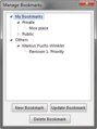 ManageBookmarks.PNG 263 × 353; 18 KB
 UpdateBookmark.PNG 499 × 353; 21 KB
 UploadRasterMap.PNG 543 × 361; 26 KB
 RasterMapAssignPermissions.PNG 543 × 361; 52 KB
 LoadRasterMapDialog.PNG 303 × 318; 29 KB
 RightsManagementDialog.PNG 711 × 318; 49 KB
 ManageProjectUsers.png 579 × 323; 32 KB
 AnErrorOccuredWhileTryingToReplaceTheExistingFile.PNG 487 × 274; 21 KB
 Colors.PNG 783 × 18; 1 KB
 SetupActivation.png 654 × 573; 41 KB
 DbSysDbsLoadFieldsFromTable.png 360 × 161; 7 KB
 ErrorMessageDbSysDbsLoadFieldsFromTable.png 360 × 161; 7 KB
 COM.png 405 × 113; 6 KB
 HTTP.png 397 × 114; 5 KB
 NewConnectionDialog.PNG 511 × 640; 44 KB
 CreateNewProjectDialogExisting2.PNG 806 × 486; 47 KB
 CSA Menu.png 282 × 405; 19 KB
 CSA Toolbar.png 443 × 28; 6 KB
 Icon LoadObjectsFromCurrentView.PNG 34 × 22; 886 bytes
 CSA CheckOutExample.png 110 × 189; 4 KB
 CheckedOutObjects.PNG 671 × 420; 56 KB
 ObjectHistory.PNG 439 × 341; 50 KB
 BackupRestore.PNG 48 × 26; 2 KB
 AdvancedLoading.PNG 567 × 366; 77 KB
 AdvancedLoading2.PNG 423 × 334; 31 KB
 CSADatabase.png 607 × 426; 49 KB
 Rightclick.png 514 × 376; 30 KB
 Bat.png 1,212 × 688; 162 KB
 Tutorial Visualization of GIS Data.pdf ; 3.63 MB
 BeispieleRectify.PNG 940 × 699; 13 KB
 DemImportLas.PNG 670 × 760; 45 KB
 DistributeHorizontal.PNG 1,048 × 175; 5 KB
 DistributeVertical.PNG 231 × 243; 4 KB
 CircularTransformation.PNG 339 × 263; 8 KB
 Icon SelectObjectwithLassoTool.PNG 29 × 28; 358 bytes
 StretchShrinkObject.PNG 310 × 157; 11 KB
 Normalmap.PNG 1,054 × 635; 178 KB
 CircularTransformationExample.PNG 1,543 × 883; 38 KB
 MultiRepresentationManager.png 628 × 407; 26 KB
 MultiRepresentationManagerSettings.png 628 × 407; 23 KB
 MultipleRepresentationManagerWithProjectsAndChanges.png 1,405 × 481; 99 KB
 MultipleRepresentationRepresentationGermanTitle.png 623 × 389; 33 KB
 MultipleRepresentationRepresentationStyleChange.png 532 × 339; 22 KB
 MultipleRepresentationOriginalMap.png 975 × 660; 76 KB
 MultipleRepresentationCopyToRepresentationContextMenu.png 409 × 292; 17 KB
 DockingPanel.PNG 1,921 × 1,159; 92 KB
 DockedPanel.PNG 1,920 × 1,160; 97 KB
 UndockedPanel.PNG 1,920 × 1,160; 79 KB
 Activation.png 654 × 518; 42 KB
 SetupInstallation.png 513 × 398; 20 KB
 SetupLanguage.png 513 × 398; 26 KB
 Activation5.png 654 × 518; 33 KB
 Activation3website.png 654 × 518; 26 KB
 Activation5website1.png 612 × 500; 21 KB
 Activation5website2.png 659 × 703; 29 KB
 Activation4webseite.png 654 × 518; 33 KB
 Activation4website.png 654 × 518; 33 KB
 SelectByLassoExample.png 800 × 318; 34 KB
 GpsViaSmartphone.png 177 × 233; 18 KB
 DemImportWizard1.png 654 × 552; 25 KB
 DemImportWizard2.png 543 × 627; 29 KB
 DemImportWizard7.png 654 × 473; 29 KB
 DemImportWizard8.png 654 × 538; 33 KB
 CsInsertObjectByMoveConnectionLine1.png 442 × 468; 46 KB
 CsInsertObjectByMoveConnectionLine3.png 444 × 473; 48 KB
 CsInsertObjectByMoveConnectionLine2.png 445 × 479; 50 KB
 CsInsertObjectByMoveConnectionLine4.png 296 × 314; 31 KB
 DemClassifyVegetationHeight.PNG 654 × 493; 33 KB
 Ocad12TrialErrorMessageCodeSigning1.png 721 × 49; 5 KB
 Ocad12TrialErrorMessageCodeSigning2.png 845 × 241; 24 KB
 Ocad12TrialErrorMessageCodeSigning3.png 414 × 315; 23 KB
 Thm40px.png 40 × 20; 583 bytes
 AlsDataImport 1.png 474 × 102; 5 KB
 AlsDataImport 2.png 210 × 203; 5 KB
 AlsDataImport 4.png 656 × 282; 25 KB
 AlsDataImport 3.png 657 × 236; 21 KB
 AlsDataImport 5.png 644 × 281; 30 KB
 AlsDataImport 6.png 958 × 604; 495 KB
 AlsDataImport 7.png 710 × 432; 220 KB
 AlsDataImport 8.png 930 × 438; 208 KB
 Move segment building edge.gif 432 × 420; 44 KB
 MoveSegmentVegetationBorderline.gif 384 × 364; 35 KB
 MoveSegmentBuildingEdge.gif 432 × 420; 44 KB
 WMSDialog1.PNG 947 × 683; 31 KB
 AddWMSServer.PNG 510 × 264; 9 KB
 ImportDxfUnsymbolized.png 569 × 487; 25 KB
 Update1.PNG 976 × 313; 13 KB
 Update2.PNG 976 × 311; 10 KB
 Update3.PNG 499 × 387; 17 KB
 Update4.PNG 499 × 387; 13 KB
 Update2A.PNG 453 × 333; 16 KB
 Edit Vertex.gif 826 × 582; 13.64 MB
 Find Objects.gif 570 × 512; 2.81 MB
 To Curve.gif 462 × 304; 739 KB
 GpsInterfaceLocationApi.png 405 × 111; 6 KB
 Move Parallel Distance.gif 494 × 352; 3.17 MB
 Move Parallel Distance Duplicate.gif 494 × 352; 2.58 MB
 OnlineMapServicesResolution.png 301 × 218; 5 KB
 NewMapWizard OsmImport Map.png 1,157 × 775; 275 KB
 MRM04.PNG 1,532 × 1,040; 137 KB
 MRM13.PNG 1,579 × 1,075; 170 KB
 MRM14.PNG 1,569 × 1,070; 168 KB
 Oim export resolution.GIF 678 × 486; 103 KB
 SymbolSetConversion Dialog.png 764 × 461; 20 KB
 CreateContourLines.png 640 × 540; 27 KB
 Ocad2018Beta.png 439 × 274; 10 KB
 Ocad2018BetaCs.png 109 × 109; 4 KB
 Ocad2018BetaMas.png 109 × 109; 4 KB
 Ocad2018BetaOri.png 109 × 109; 4 KB
 Ocad2018BetaSta.png 109 × 109; 3 KB
 Ocad2018BetaDownload.png 455 × 435; 19 KB
 MoveOverlappingVerticesSegments.gif 888 × 576; 928 KB
 MapIssuePoint.PNG 457 × 367; 320 KB
 OcadServiceUpdateDownload.png 500 × 208; 32 KB
 OcadServiceUpdateSave.png 500 × 273; 46 KB
 OcadServiceUpdateCloseOCAD.png 502 × 393; 49 KB
 Corridor6.png 390 × 51; 2 KB
 NewMapWizard OsmImport.png 659 × 500; 30 KB
 CruzGrande.PNG 750 × 691; 419 KB
 DEMHillShading.png 640 × 540; 16 KB
 DEMSlopeGradient.png 640 × 540; 14 KB
 LPM.png 801 × 594; 334 KB
 LPMLoad.png 557 × 417; 18 KB
 LPMFilteringClassification.png 931 × 543; 33 KB
 LPMFilteringHeightOverGround.png 931 × 543; 189 KB
 LPMFilteringIntensity.png 931 × 543; 274 KB
 LPMFilteringVegetationDensity.png 931 × 543; 198 KB
 LPMMapSample.png 800 × 594; 105 KB
 LPMRasterMap.png 800 × 594; 242 KB
 LPMProfile2.png 1,111 × 606; 132 KB
 OCAD Linux KnownIssue3.PNG 409 × 478; 34 KB
 ArrowKeys.gif 600 × 400; 201 KB
 MoveUpDown.png 51 × 23; 318 bytes
 Cloud ChooseALicense.png 624 × 213; 47 KB
 Activation3online.png 644 × 510; 10 KB
 Activation6.png 646 × 510; 8 KB
 RouteAnalyser vegetation.png 361 × 235; 12 KB
 ShortestRouteLength.png 577 × 273; 12 KB
 RouteAnalyzer Example.png 580 × 300; 48 KB
 OcadServiceUpdateMenu.png 374 × 222; 8 KB
 DownloadUpdate3.png 545 × 181; 6 KB
 RouteAnalyser bar open.png 937 × 542; 80 KB
 NewMapWizard ImportData.png 846 × 678; 21 KB
 MapScale DifferentScalesCS.png 713 × 781; 54 KB
 RouteAnalyzer.gif 424 × 280; 1.38 MB
 MapScale Example.png 580 × 300; 231 KB
 OnlineMapServicesLabel.png 556 × 326; 116 KB
 LicenseTransferUtility.png 421 × 411; 9 KB
 UpdatingOrienteeringMaps02.png 600 × 350; 202 KB
 RouteAnalyzer Editing.png 420 × 290; 25 KB
 MapAnt.png 1,142 × 371; 1.23 MB
 MapRunF02.png 540 × 1,080; 910 KB
 CTRLSpaceSegment.gif 1,000 × 640; 3.3 MB
 CTRLSpaceVertex.gif 1,000 × 640; 3.11 MB
 LiveloxDialog02.png 517 × 510; 224 KB
 LiveloxDialog03.png 407 × 219; 13 KB
 LiveloxDialog01.png 888 × 667; 73 KB
 LiveloxDialog04.png 800 × 535; 149 KB
 Edit Functions Toolbar.png 726 × 50; 5 KB
 Symbolsatz ISMTBOM200x FinalDraft.png 391 × 320; 23 KB
 Symbolsatz ISSprOM2019 2.png 393 × 278; 10 KB
 Sketchapp info.svg 11 × 20; 636 bytes
 Sketchapp line.svg 6 × 36; 221 bytes
 Sketchapp trash.svg 64 × 64; 891 bytes
 Qr-Testflight-OCAD Sketch iOS.png 66 × 66; 471 bytes
 Qr-GooglePlayStore-OCAD Sketch Android.png 66 × 66; 475 bytes
 NotFound.png 600 × 161; 13 KB
 BlendModeComparison.png 580 × 300; 47 KB
 ImportMap BlendMode NoCut.png 580 × 300; 88 KB
 LicenseActivationDeactivted.png 491 × 211; 11 KB


