Uncategorized files
Jump to navigation
Jump to search
Showing below up to 500 results in range #501 to #1,000.
View (previous 500 | next 500) (20 | 50 | 100 | 250 | 500)
 DrawingModeHint.PNG 628 × 278; 18 KB
 DrawingModeStairway.PNG 23 × 24; 306 bytes
 DtmHillShading.png 2,001 × 2,001; 4.98 MB
 Duplicate object.gif 376 × 198; 342 KB
 DxfImport1.png 425 × 424; 14 KB
 DxfImport2.png 439 × 435; 23 KB
 DxfImport3.png 410 × 394; 11 KB
 EOCDDocumentInfo.PNG 381 × 494; 25 KB
 EditAndDrawingToolbar.JPG 591 × 31; 14 KB
 EditAndDrawingToolbar.png 668 × 50; 5 KB
 EditAndDrawingToolbarWithSketchMode.png 565 × 56; 19 KB
 EditFunctionsToolbar.PNG 506 × 29; 3 KB
 EditFunctionsToolbar.png 726 × 50; 5 KB
 EditLayoutObjects.jpg 321 × 468; 50 KB
 EditMarkedRoute.png 555 × 192; 9 KB
 EditSelection.PNG 394 × 181; 19 KB
 EditTextControlDescription.PNG 909 × 451; 50 KB
 EditToolbar.JPG 324 × 28; 11 KB
 EditVertex.PNG 192 × 140; 6 KB
 EditWMSServerProperties.PNG 1,718 × 903; 43 KB
 EditWMSServerProperties.png 586 × 321; 26 KB
 Edit Functions Toolbar.png 726 × 50; 5 KB
 Edit Vertex.gif 826 × 582; 13.64 MB
 EditingMoveRightAngleVertexSegments.png 400 × 230; 20 KB
 EditingMoveSegment.png 400 × 238; 30 KB
 EditingMoveSegmentNotRectangular.png 400 × 220; 19 KB
 EditingMoveVertexWithArrowKeys.png 638 × 481; 19 KB
 EllipseTool.PNG 28 × 28; 557 bytes
 EncryptedOCADFilePassword.PNG 431 × 246; 21 KB
 EndSymbol.PNG 642 × 291; 13 KB
 Ent40px.PNG 40 × 20; 700 bytes
 EntireMap.JPG 27 × 26; 8 KB
 EnvelopePolygon.PNG 1,881 × 616; 42 KB
 ErrorInDatabase1.png 654 × 573; 29 KB
 ErrorMessageBorlandEngineInstall.png 377 × 171; 20 KB
 ErrorMessageDbSysDbsLoadFieldsFromTable.png 360 × 161; 7 KB
 ErrorMessageMissingEtzw32dll.PNG 473 × 171; 19 KB
 ErrorMessageOCAD11BetaInstallation.png 478 × 171; 18 KB
 ErrorStringResource.PNG 342 × 171; 12 KB
 Event.gif 24 × 24; 914 bytes
 EventTitel Example.png 200 × 120; 6 KB
 Example.jpg 17 × 17; 459 bytes
 Export.PNG 683 × 506; 56 KB
 ExportButterfly.PNG 381 × 387; 10 KB
 ExportControlDescriptions1.png 558 × 688; 28 KB
 ExportControlDescriptions2.png 406 × 639; 15 KB
 ExportControlDescriptions3.png 518 × 466; 11 KB
 ExportControlDescriptions4.png 861 × 570; 58 KB
 ExportControlDescriptions5.png 461 × 614; 19 KB
 ExportCourseMaps.png 359 × 400; 22 KB
 ExportCourseMapsPlaceCoursesAtOriginalPosition.png 1,730 × 758; 448 KB
 ExportCourseMapsPlaceCoursesBelowEachOther.png 344 × 988; 186 KB
 ExportCourseMapsPlaceCoursesBesideEachOther.png 1,722 × 308; 221 KB
 ExportCourseScheme1.PNG 144 × 290; 6 KB
 ExportCourseScheme2.PNG 682 × 232; 13 KB
 ExportEncryptedFile.PNG 383 × 585; 29 KB
 ExportKmzGarminCustomMapsTiles.png 200 × 17; 690 bytes
 ExportOimAjaxError0.png 240 × 144; 1 KB
 ExportPdfExampleCMYK.png 262 × 324; 9 KB
 ExportPdfExampleColorTable.png 912 × 169; 13 KB
 ExportPdfExampleNormalView.png 369 × 456; 7 KB
 ExportPdfExampleSpotColorView.png 369 × 456; 7 KB
 ExportPdfExampleSpotColorsBlack.png 265 × 327; 7 KB
 ExportPdfExampleSpotColorsBlue.png 264 × 324; 3 KB
 ExportPdfExampleSpotColorsCombinded.png 1,051 × 678; 89 KB
 ExportPdfExampleSpotColorsCombindedAcrobatReader1.png 457 × 565; 27 KB
 ExportPdfExampleSpotColorsCombindedAcrobatReader2.png 1,034 × 679; 50 KB
 ExportPdfExampleSpotColorsCombindedAcrobatReader3.png 457 × 565; 34 KB
 ExportPdfExampleSpotColorsGreen.png 263 × 325; 4 KB
 ExportPdfExampleSpotColorsYellow.png 265 × 326; 2 KB
 ExportRelayDialog.PNG 423 × 414; 25 KB
 Export Courses KMZ.PNG 1,921 × 994; 2.69 MB
 ExportedCourse.PNG 706 × 586; 119 KB
 ExtractCliffFeatures.png 650 × 364; 160 KB
 ExtractCliffFeatures2.png 650 × 369; 267 KB
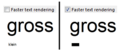 FasterTextRendering.PNG 297 × 129; 6 KB
 FileErrorMessageOCAD11BetaInstallation.png 478 × 171; 18 KB
 FileFolderPuzzleO.PNG 296 × 281; 7 KB
 Fill.gif 724 × 416; 957 KB
 FillBoundedArea.gif 637 × 404; 1.89 MB
 FillBoundedAreasLimits.png 340 × 208; 29 KB
 FillTool.PNG 28 × 28; 590 bytes
 FilledCircleTool.PNG 28 × 28; 507 bytes
 FilledRectangleTool.PNG 28 × 28; 394 bytes
 FindObjectDialog.PNG 340 × 174; 16 KB
 FindSelectedObjects.gif 824 × 584; 933 KB
 FindUTMZone.PNG 338 × 219; 20 KB
 Find Objects.gif 570 × 512; 2.81 MB
 Finnland.gif 22 × 15; 892 bytes
 FirstAidPoint.png 24 × 24; 168 bytes
 FirstAidPoint Example.png 200 × 120; 34 KB
 FirstFreeCode.png 24 × 24; 218 bytes
 Firstpoint.GIF 14 × 13; 845 bytes
 Following Existing Objects.gif 826 × 582; 6.03 MB
 Framecol.gif 194 × 53; 1 KB
 FramingModeLine.PNG 609 × 117; 9 KB
 FramingModeOff.PNG 609 × 62; 4 KB
 FramingModeShadow.PNG 609 × 70; 7 KB
 Frankreich.gif 22 × 15; 902 bytes
 FreehandModeforTablet.png 600 × 400; 225 KB
 Freehand ExportPDF Settings.gif 251 × 427; 8 KB
 Freehand To Curve.PNG 416 × 198; 9 KB
 FullLine.PNG 624 × 39; 2 KB
 FullLine MainLine.PNG 473 × 448; 26 KB
 FullStopHelp.PNG 608 × 342; 14 KB
 Fullline.gif 289 × 13; 936 bytes
 FunnelTapes.png 77 × 19; 683 bytes
 FunnelTapesExample.png 236 × 46; 5 KB
 GIS AddTextsByRecords.PNG 505 × 403; 25 KB
 GIS AssignSymbolByRecords.PNG 442 × 422; 27 KB
 GIS ImportShapeFiles.PNG 463 × 713; 40 KB
 GIS Symbolsset.PNG 1,073 × 808; 60 KB
 GPS Orienteering Logo.png 72 × 72; 6 KB
 GUI.JPG 1,402 × 912; 249 KB
 GeneralizeBuildings.PNG 520 × 502; 22 KB
 GenerateMapPreview.PNG 23 × 23; 3 KB
 GenerateQrCode.png 544 × 371; 13 KB
 GenerateQrCodeExample.png 580 × 300; 61 KB
 Geneva.png 700 × 400; 216 KB
 GeoPackageImport1.png 656 × 268; 10 KB
 GeoPackageImport2.png 662 × 296; 11 KB
 GeoPackageImport3.png 824 × 255; 8 KB
 Geolog.gif 296 × 48; 1 KB
 GeologicalLine.PNG 625 × 89; 5 KB
 GeologicalLine Decrease.PNG 471 × 452; 21 KB
 GeologicalLine Distances.PNG 476 × 447; 25 KB
 GeologicalLine SymbolEditorA.PNG 398 × 399; 10 KB
 GeologicalLine SymbolEditorB.PNG 401 × 398; 10 KB
 GeologicalLine Symbols.PNG 470 × 450; 25 KB
 GeoreferencedNonGeoreferencedMap.png 866 × 246; 445 KB
 GetObjects.PNG 876 × 675; 280 KB
 GetObjectsFromCurrentView.PNG 23 × 23; 3 KB
 GhostscriptFilePath.png 597 × 251; 8 KB
 GhostscriptFilePathNew.png 386 × 57; 2 KB
 GoogleMapsLayers.png 787 × 229; 298 KB
 GoogleMapsUncheckLabels.png 812 × 218; 225 KB
 GoogleStreetView.jpg 754 × 659; 175 KB
 GoogleStreetViewDragDirection.png 293 × 373; 31 KB
 GpsInterfaceLocationApi.png 405 × 111; 6 KB
 GpsRealTimeShowTail.png 573 × 279; 15 KB
 GpsRealTimeThickerCursor.png 627 × 382; 19 KB
 GpsViaSmartphone.png 177 × 233; 18 KB
 Gradient.PNG 417 × 210; 15 KB
 Graphicmodifications.gif 700 × 500; 1.14 MB
 Grossbritanien.gif 22 × 11; 1 KB
 GroupUngroup.png 447 × 134; 8 KB
 HTTP.png 397 × 114; 5 KB
 Hatch.PNG 417 × 379; 30 KB
 HatchAreas.PNG 1,068 × 814; 121 KB
 HatchAreasExample.PNG 1,024 × 125; 140 KB
 HatchExample.PNG 756 × 167; 6 KB
 HatchTip.PNG 533 × 321; 13 KB
 HeighOnASlope.PNG 109 × 67; 987 bytes
 Help.gif 763 × 429; 24 KB
 Highway.PNG 808 × 135; 8 KB
 Highway DoubleLine.PNG 478 × 452; 24 KB
 Highway Framing.PNG 476 × 446; 19 KB
 Highway MainLine.PNG 478 × 457; 20 KB
 HillShading.PNG 778 × 778; 781 KB
 HillShading2.PNG 682 × 682; 397 KB
 HillShadingPreview.PNG 653 × 373; 136 KB
 HillShading multidirectional.png 851 × 528; 446 KB
 Hint.jpg 20 × 20; 15 KB
 HoleWithOnlyTwoVertices.PNG 239 × 183; 3 KB
 HowTos.gif 465 × 360; 48 KB
 Hundschopf.png 700 × 400; 116 KB
 HypsometricMap.PNG 469 × 472; 154 KB
 IOrienteering Logo.png 500 × 479; 104 KB
 ISMTBOM2021CourseSetting.png 392 × 93; 3 KB
 ISMTBOM2021 CS.png 394 × 71; 3 KB
 ISOM 2017 Comparison.png 803 × 786; 97 KB
 ISOM 2017 Comparison 15000.png 900 × 770; 161 KB
 ISSkiOM 2019 CS.png 395 × 95; 4 KB
 IconDistributeObjects Horizontal.PNG 26 × 26; 307 bytes
 IconDistributeObjects Vertical.PNG 26 × 26; 286 bytes
 IconEditor.JPG 490 × 383; 75 KB
 IconFillBoundedAreaMode.png 23 × 23; 823 bytes
 IconGSV.PNG 16 × 16; 224 bytes
 IconSketchMode.png 23 × 23; 371 bytes
 IconSmooth.PNG 24 × 24; 344 bytes
 Icon AccuracyCircle.PNG 22 × 22; 344 bytes
 Icon AddGPSPositionToCalculateAverage.PNG 22 × 22; 384 bytes
 Icon AlignObjectsHorizontal.PNG 23 × 23; 3 KB
 Icon AlignObjectsHorizontalCoordinateCentered.PNG 27 × 26; 266 bytes
 Icon AlignObjectsVertical.PNG 23 × 23; 3 KB
 Icon AutomaticJoining.PNG 23 × 23; 4 KB
 Icon BackgroundMapManager.PNG 18 × 18; 465 bytes
 Icon CSA Redo.PNG 22 × 22; 474 bytes
 Icon CSA Undo.PNG 22 × 22; 479 bytes
 Icon ChangeSymbolForAllObjectsWithThisSymbol.PNG 23 × 23; 4 KB
 Icon ChangeSymbolOfObject.PNG 23 × 23; 4 KB
 Icon ChangeToBezierCurve.PNG 23 × 23; 4 KB
 Icon ChangeToPolyline.png 23 × 23; 3 KB
 Icon CheckIn.PNG 25 × 25; 446 bytes
 Icon CheckOut.PNG 28 × 28; 409 bytes
 Icon CircleMode.PNG 23 × 23; 4 KB
 Icon ConnectDisconnect.PNG 22 × 22; 363 bytes
 Icon ConvertToGraphicObject.PNG 23 × 23; 4 KB
 Icon CornerVertex.PNG 23 × 23; 4 KB
 Icon Crop.PNG 18 × 18; 518 bytes
 Icon CurveMode.PNG 23 × 23; 4 KB
 Icon Cut.PNG 23 × 23; 4 KB
 Icon CutArea.PNG 23 × 23; 4 KB
 Icon CutHole.PNG 23 × 23; 4 KB
 Icon DashVertex.PNG 23 × 23; 4 KB
 Icon Delete.PNG 23 × 23; 4 KB
 Icon Delete2.PNG 23 × 24; 463 bytes
 Icon DeleteObjectsInDatabase.PNG 22 × 22; 310 bytes
 Icon DistributeObjectsHorizontalCoordinate.PNG 20 × 19; 466 bytes
 Icon DistributeObjectsVerticalCoordinate.PNG 15 × 18; 431 bytes
 Icon DoDatabaseMaintenance.PNG 22 × 22; 597 bytes
 Icon DrawingMultiplePointObjects.PNG 23 × 23; 3 KB
 Icon DuplicateObject.PNG 23 × 23; 4 KB
 Icon EllipseMode.PNG 23 × 23; 4 KB
 Icon FillOrMakeBorder.PNG 23 × 23; 4 KB
 Icon FindGPSMarker.PNG 22 × 22; 343 bytes
 Icon FindSelectedObjects.PNG 23 × 23; 4 KB
 Icon FreehandMode.PNG 23 × 23; 4 KB
 Icon GPSFilter.PNG 22 × 22; 371 bytes
 Icon GeneralizeBuildings.PNG 20 × 18; 518 bytes
 Icon GenerateMapPreview.PNG 22 × 22; 542 bytes
 Icon GetObjectsFromCurrentView.PNG 22 × 22; 592 bytes
 Icon ImportMap.PNG 22 × 22; 439 bytes
 Icon IndicateDirectionOfAreaPatternPointOrTextObject.PNG 23 × 23; 4 KB
 Icon InterpolateObjects.PNG 23 × 23; 3 KB
 Icon Join.PNG 23 × 23; 3 KB
 Icon LaserDistance.PNG 23 × 23; 3 KB
 Icon LoadObjectsFromCurrentView.PNG 34 × 22; 886 bytes
 Icon ManageServerBookmarks.PNG 22 × 22; 378 bytes
 Icon Measure.PNG 23 × 23; 4 KB
 Icon Merge.PNG 23 × 23; 4 KB
 Icon MoveDuplicatebySpecifiedDistance.PNG 20 × 19; 689 bytes
 Icon MoveParallel.PNG 23 × 23; 4 KB
 Icon New.PNG 23 × 23; 4 KB
 Icon NormalVertex.PNG 23 × 23; 4 KB
 Icon NumericMode.PNG 23 × 23; 3 KB
 Icon ObjectHistory.PNG 22 × 22; 381 bytes
 Icon ObjectInformation.PNG 17 × 20; 414 bytes
 Icon Open.PNG 23 × 23; 4 KB
 Icon OpenGoogleStreetView.PNG 24 × 24; 710 bytes
 Icon OpenRealTimeGPSSettings.PNG 22 × 22; 246 bytes
 Icon Pan.PNG 22 × 22; 4 KB
 Icon PanLocked.PNG 22 × 23; 4 KB
 Icon PauseGPSMeasurement.PNG 22 × 22; 266 bytes
 Icon Print.PNG 23 × 23; 4 KB
 Icon RectangularLineMode.PNG 23 × 23; 4 KB
 Icon RectangularMode.PNG 23 × 23; 4 KB
 Icon Redo.PNG 23 × 23; 4 KB
 Icon RemoveVertex.PNG 23 × 23; 4 KB
 Icon Reshape.PNG 23 × 23; 4 KB
 Icon ReverseObject.PNG 23 × 23; 4 KB
 Icon RightsManagement.PNG 22 × 22; 643 bytes
 Icon RotateEnterAngle.PNG 23 × 23; 3 KB
 Icon RotateObject.PNG 23 × 23; 4 KB
 Icon RotateObjectAngle.png 23 × 23; 474 bytes
 Icon Save.PNG 23 × 23; 4 KB
 Icon SaveForOfflineWork.PNG 22 × 22; 630 bytes
 Icon SelectAndEditObject.PNG 23 × 23; 3 KB
 Icon SelectDuplicateObjects.PNG 20 × 20; 505 bytes
 Icon SelectLineTextObjectswithLinetooShort.PNG 22 × 21; 435 bytes
 Icon SelectObjectAndEditVertex.PNG 23 × 23; 4 KB
 Icon SelectObjectWithLassoTool.PNG 20 × 19; 540 bytes
 Icon SelectObjectwithLassoTool.PNG 29 × 28; 358 bytes
 Icon SelectSelfIntersectedObjects.PNG 20 × 20; 482 bytes
 Icon Setup.PNG 25 × 26; 398 bytes
 Icon ShowCheckedOutObjects.PNG 22 × 22; 588 bytes
 Icon ShowEntireMap.PNG 22 × 23; 4 KB
 Icon ShowGrid.PNG 23 × 23; 3 KB
 Icon ShowProjectInformation.PNG 22 × 22; 693 bytes
 Icon ShowRulerGuides.PNG 18 × 19; 448 bytes
 Icon ShowRulers.PNG 19 × 19; 471 bytes
 Icon Smooth.PNG 23 × 23; 4 KB
 Icon Snapping.PNG 23 × 23; 4 KB
 Icon StartGPSMeasurement.PNG 22 × 22; 299 bytes
 Icon StopGPSMeasurement.PNG 22 × 22; 251 bytes
 Icon StraightLineMode.PNG 23 × 23; 3 KB
 Icon SymbolStatusManager.PNG 18 × 18; 516 bytes
 Icon Undo.PNG 23 × 23; 3 KB
 Icon ZoomIn.PNG 22 × 23; 4 KB
 Icon ZoomInLocked.PNG 22 × 23; 4 KB
 Icon ZoomOut.PNG 22 × 23; 4 KB
 Icon ZoomOutToPreviousView.PNG 22 × 23; 4 KB
 Icon ZoomToNextView.PNG 23 × 23; 3 KB
 Icon ZoomToPreviousView.PNG 22 × 23; 4 KB
 Icon ZoomtoSelectedObjects.PNG 20 × 20; 553 bytes
 IgnMapJpeg2000 1.png 1,044 × 793; 528 KB
 IgnMapJpeg2000 2.png 351 × 551; 32 KB
 ImportDxfUnsymbolized.png 569 × 487; 25 KB
 ImportFreehandXml.PNG 476 × 276; 12 KB
 ImportMapDialog.PNG 337 × 283; 19 KB
 ImportMap BlendMode NoCut.png 580 × 300; 88 KB
 ImportMap NoBlendMode NoCut.png 580 × 300; 69 KB
 ImportMaps.PNG 23 × 23; 3 KB
 ImportOCADMap.png 461 × 619; 29 KB
 ImportOcadMap.png 461 × 614; 16 KB
 ImportShapeFile.PNG 710 × 580; 38 KB
 ImportShapeFileOrienteering.PNG 710 × 388; 29 KB
 ImportShapeFileOrienteeringDatabaseTable.PNG 777 × 230; 16 KB
 ImportShapeFileOrienteeringViewTable.PNG 21 × 21; 262 bytes
 ImportShapeText1.png 841 × 561; 78 KB
 ImportShapeText2.png 491 × 387; 22 KB
 ImportShapeText3.png 841 × 561; 79 KB
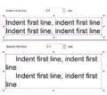 IndentFirstLine.PNG 424 × 373; 27 KB
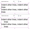 IndentOtherLines.PNG 397 × 396; 29 KB
 Index1.gif 120 × 120; 10 KB
 Index2.gif 120 × 120; 12 KB
 Index3.gif 120 × 120; 11 KB
 Index4.gif 120 × 120; 10 KB
 IndicateDirectionofPattern.PNG 607 × 377; 13 KB
 Indicate Direction.gif 226 × 170; 450 KB
 Indicate Direction Area.gif 226 × 244; 635 KB
 InflectionPointOfBezierCurve.PNG 275 × 174; 12 KB
 InfluenceDashedNormal.PNG 191 × 74; 3 KB
 InfluenceDashedVertex.PNG 199 × 94; 4 KB
 InfraredImageFalseColors.png 696 × 461; 229 KB
 InfraredImageTrueColors.png 693 × 461; 222 KB
 InsertCourseObject.PNG 497 × 423; 13 KB
 InsertCourseObjectIcon.png 80 × 21; 408 bytes
 InsertCourseObjectToMultipleCourses.PNG 377 × 609; 12 KB
 InsertGlyphs.PNG 998 × 630; 76 KB
 InsertionLine.PNG 67 × 44; 490 bytes
 Insertvar.gif 107 × 80; 1 KB
 Installation1.png 299 × 152; 4 KB
 Installation10.png 499 × 387; 10 KB
 Installation11.png 499 × 387; 15 KB
 Installation2.png 499 × 387; 15 KB
 Installation3.png 499 × 387; 23 KB
 Installation4.png 499 × 387; 11 KB
 Installation5.png 499 × 387; 8 KB
 Installation6.png 499 × 387; 16 KB
 Installation7.png 499 × 387; 18 KB
 Installation8.png 499 × 387; 13 KB
 Installation9.png 499 × 387; 16 KB
 InternalErrorReadXmlLicenseFile.png 486 × 161; 20 KB
 InternalErrorTOcdIsGridZoneValidUnknownGrid.png 436 × 171; 18 KB
 InterpolateLines.png 525 × 163; 24 KB
 InterpolatePoints.png 731 × 113; 16 KB
 Interpolate Line Objects.gif 538 × 462; 3.43 MB
 Interpolate Point Objects.gif 492 × 228; 1.1 MB
 Intersection.PNG 477 × 134; 22 KB
 InvalidExteriorRing.PNG 452 × 184; 8 KB
 Island1.PNG 658 × 331; 52 KB
 Island2.PNG 473 × 315; 9 KB
 Island3.PNG 651 × 323; 16 KB
 Italien.gif 22 × 15; 920 bytes
 Japan.gif 22 × 15; 883 bytes
 Join.gif 384 × 240; 382 KB
 Join Merge.gif 382 × 204; 1,018 KB
 Joining Lines.PNG 448 × 501; 14 KB
 KML Export Course.PNG 1,706 × 922; 77 KB
 KeepStraightParts.png 1,000 × 916; 54 KB
 Keyline.PNG 658 × 210; 38 KB
 KeylineExample.PNG 1,024 × 124; 126 KB
 Kindhausen.PNG 1,001 × 684; 48 KB
 Kindhausen01.PNG 920 × 686; 180 KB
 Kindhausen02.PNG 1,003 × 709; 504 KB
 Kindhausen03.PNG 997 × 712; 601 KB
 Kindhausen05.PNG 932 × 690; 83 KB
 Kindhausen ConvertImportedLayerToSymbols2.PNG 443 × 419; 26 KB
 Kindhausen CreateContourLines.PNG 631 × 281; 23 KB
 Kindhausen CreateHillShading.PNG 590 × 311; 21 KB
 Kindhausen DEMImport.PNG 514 × 648; 35 KB
 Kindhausen ImportFile.PNG 460 × 474; 30 KB
 LPM.png 801 × 594; 334 KB
 LPMFilteringClassification.png 931 × 543; 33 KB
 LPMFilteringHeightOverGround.png 931 × 543; 189 KB
 LPMFilteringIntensity.png 931 × 543; 274 KB
 LPMFilteringVegetationDensity.png 931 × 543; 198 KB
 LPMLoad.png 557 × 417; 18 KB
 LPMMapSample.png 800 × 594; 105 KB
 LPMProfile2.png 1,111 × 606; 132 KB
 LPMRasterMap.png 800 × 594; 242 KB
 LargeSquare.JPG 18 × 21; 8 KB
 LargeSquareCross.png 18 × 21; 337 bytes
 LaserDistanceMeterDataTab.PNG 298 × 313; 12 KB
 LaserDistanceMeterOptionTab.PNG 302 × 320; 13 KB
 LaserRangefinderConnectionTest.png 313 × 361; 13 KB
 LaserRangefinderDataTab.png 273 × 301; 9 KB
 Laufenburg2021.PNG 984 × 548; 448 KB
 Layout.gif 800 × 600; 5.77 MB
 LayoutImage.png 434 × 113; 4 KB
 LayoutObjectList.gif 316 × 192; 172 KB
 Layout EditLayoutObjects.png 1,286 × 676; 301 KB
 Layout OCADObejcts.png 883 × 379; 108 KB
 Layout PaperSize.png 1,008 × 612; 167 KB
 Layout Rulers.png 899 × 468; 180 KB
 LegVariation.PNG 907 × 643; 211 KB
 LegVariationSymbol.PNG 54 × 67; 492 bytes
 LegVariationSymbol2.PNG 82 × 113; 1 KB
 LegVariationTable.PNG 374 × 106; 4 KB
 Legend VegetationHeight.PNG 142 × 182; 3 KB
 LengthenLineTextObjects.png 423 × 170; 9 KB
 LiDARImportXML.png 800 × 450; 774 KB
 LicenseActivation.png 491 × 211; 10 KB
 LicenseActivationDeactivted.png 491 × 211; 11 KB
 LicenseDeactivated.png 412 × 147; 3 KB
 LicenseManager.png 1,087 × 589; 54 KB
 LicenseManagerChooseALicense.png 718 × 248; 171 KB
 LicenseTransferUtility.gif 450 × 300; 1.06 MB
 LicenseTransferUtility.png 421 × 411; 9 KB
 LicenseTransfer SingleUser.png 626 × 587; 23 KB
 LicenseTransfer Team.png 626 × 587; 20 KB
 Lidar.png 1,406 × 375; 454 KB
 LidarPointCloudManagerStatisticsExcelErrorMessage.png 469 × 160; 4 KB
 LidarPointCloudManager Classification.png 453 × 431; 38 KB
 LidarPointCloudManager Example.png 1,094 × 519; 199 KB
 LidarPointCloudManager HeightOverGround.png 452 × 429; 179 KB
 LidarPointCloudManager Information.png 313 × 361; 10 KB
 LidarPointCloudManager Intensity.png 453 × 430; 238 KB
 LidarPointCloudManager OrienteeringBaseMapColors.png 598 × 253; 15 KB
 LidarPointCloudManager PointCloud.png 1,010 × 656; 86 KB
 LidarPointCloudManager PointCloud ClassificationLowVegetions.png 448 × 428; 50 KB
 LidarPointCloudManager PointCloud ClassificationMediumVegetions.png 452 × 429; 50 KB
 LidarPointCloudManager PointCloud ClassificationOption.png 413 × 374; 15 KB
 LidarPointCloudManager PointCloud Classification ReturnTypes.png 415 × 101; 2 KB
 LidarPointCloudManager PointCloud ImportOptions.png 434 × 96; 3 KB
 LidarPointCloudManager PointCloud Samples.png 490 × 368; 17 KB
 LidarPointCloudManager PointCloud SymbolBox.png 183 × 62; 1 KB
 LidarPointCloudManager PointCloud Symbols.png 166 × 134; 4 KB
 LidarPointCloudManager Profile.png 1,388 × 598; 59 KB
 LidarPointCloudManager RasterMap.png 958 × 628; 122 KB
 LidarPointCloudManager ShowFrame.png 412 × 392; 35 KB
 LidarPointCloudManager Statistics.png 422 × 169; 4 KB
 LidarPointCloudManager Thresholds.png 865 × 288; 24 KB
 LidarPointCloudManager ThresholdsExcel.png 502 × 217; 14 KB
 LidarPointCloudManager VegetationDensity.png 453 × 427; 81 KB
 LineAppearanceAsOcad10Warning.png 496 × 214; 21 KB
 LineAppearanceOcad10.png 862 × 460; 33 KB
 LineAppearanceOcad11.png 862 × 466; 31 KB
 LineLength.PNG 411 × 369; 10 KB
 LineSpacing.PNG 385 × 420; 22 KB
 LineStyle.PNG 386 × 574; 14 KB
 LineSymbol.JPG 468 × 445; 42 KB
 LineSymbolDistances.PNG 493 × 469; 35 KB
 LineSymbols.PNG 557 × 223; 19 KB
 LineTextSymbol.JPG 412 × 448; 36 KB
 LineTextSymbolGeneral.PNG 433 × 471; 37 KB
 LineTextSymbols.PNG 558 × 176; 11 KB
 LineTool.PNG 28 × 28; 567 bytes
 Line Icon.PNG 27 × 27; 595 bytes
 Linebtn.gif 23 × 22; 887 bytes
 Linux Wine Config 2019.png 414 × 480; 34 KB
 LivePreview.PNG 658 × 210; 19 KB
 LivePreviewEnabled.gif 600 × 400; 1.85 MB
 Live Preview.png 580 × 300; 6 KB
 LiveloxAuthorization01.png 527 × 381; 28 KB
 LiveloxAuthorization02.png 330 × 126; 7 KB
 LiveloxAuthorization03.png 611 × 622; 76 KB
 LiveloxAuthorization04.png 415 × 599; 98 KB
 LiveloxAuthorization05.png 601 × 173; 41 KB
 LiveloxDialog01.png 888 × 667; 73 KB
 LiveloxDialog02.png 517 × 510; 224 KB
 LiveloxDialog03.png 407 × 219; 13 KB
 LiveloxDialog04.png 800 × 535; 149 KB
 LoadColorsAndSymbolsFrom.png 397 × 255; 7 KB
 LoadObjectsFromSymbolTree.PNG 465 × 391; 26 KB
 LoadRasterMapDialog.PNG 303 × 318; 29 KB
 LoadSymbolsFromTemplate.PNG 203 × 117; 2 KB
 LocalTransformation.png 335 × 261; 12 KB
 LocalTransformationExample.png 800 × 309; 118 KB
 LockObjects.png 24 × 24; 258 bytes
 Logo Example.png 200 × 120; 37 KB
 MRM01.PNG 634 × 489; 12 KB
 MRM04.PNG 1,532 × 1,040; 137 KB
 MRM05.PNG 1,083 × 199; 100 KB
 MRM13.PNG 1,579 × 1,075; 170 KB
 MRM14.PNG 1,569 × 1,070; 168 KB
 MRM15.PNG 578 × 225; 38 KB
 MRM16.PNG 841 × 399; 188 KB
 MRM17.PNG 1,026 × 662; 306 KB
 MRM18.PNG 409 × 147; 7 KB
 MRM19.PNG 313 × 147; 6 KB
 MRM20.PNG 1,179 × 797; 656 KB
 MRM21.PNG 678 × 722; 512 KB
 MR ManageRepresentations.png 634 × 489; 9 KB
 MR Representations.png 634 × 489; 13 KB
 MR Settings.png 634 × 489; 12 KB
 MacOSX1.PNG 1,440 × 900; 1.9 MB
 MacOSX3.PNG 1,440 × 900; 2.31 MB
 MacOSX4.PNG 1,440 × 900; 783 KB
 MacOSX5.PNG 1,440 × 900; 1.78 MB
 MacOSX6.JPG 3,264 × 2,448; 1.77 MB
 MagneticDeclination.png 829 × 708; 216 KB
 MainLineLineSymbolDialog.PNG 475 × 452; 29 KB
 MainSymbolA.PNG 660 × 596; 24 KB
 MajorRoadMiddleLineFrameDashed.PNG 808 × 91; 7 KB
 MakeGraphicModifications.gif 850 × 600; 1.74 MB
 ManageBackgroundMap.PNG 994 × 343; 25 KB
 ManageBackgroundMap1.png 746 × 204; 13 KB
 ManageBackgroundMapEncryptedIcon.png 874 × 189; 23 KB
 ManageBackgroundMapEncryptedInfo.png 327 × 255; 17 KB
 ManageBackgroundMapInfo.png 356 × 235; 18 KB
 ManageBackgroundMapInfoOcad.png 366 × 271; 13 KB
 ManageBookmarks.PNG 263 × 353; 18 KB
 ManageProjectUsers.png 579 × 323; 32 KB
 ManageServerBookmarks.PNG 23 × 23; 3 KB
 ManageSketchFeatures.png 836 × 510; 27 KB
 MandatoryCrossingPoint.png 47 × 24; 245 bytes
 MandatoryCrossingPoint Example.png 200 × 120; 13 KB


