Uncategorized files
Jump to navigation
Jump to search
Showing below up to 100 results in range #551 to #650.
View (previous 100 | next 100) (20 | 50 | 100 | 250 | 500)
 ExportCourseMaps.png 359 × 400; 22 KB
 ExportCourseMapsPlaceCoursesAtOriginalPosition.png 1,730 × 758; 448 KB
 ExportCourseMapsPlaceCoursesBelowEachOther.png 344 × 988; 186 KB
 ExportCourseMapsPlaceCoursesBesideEachOther.png 1,722 × 308; 221 KB
 ExportCourseScheme1.PNG 144 × 290; 6 KB
 ExportCourseScheme2.PNG 682 × 232; 13 KB
 ExportEncryptedFile.PNG 383 × 585; 29 KB
 ExportKmzGarminCustomMapsTiles.png 200 × 17; 690 bytes
 ExportOimAjaxError0.png 240 × 144; 1 KB
 ExportPdfExampleCMYK.png 262 × 324; 9 KB
 ExportPdfExampleColorTable.png 912 × 169; 13 KB
 ExportPdfExampleNormalView.png 369 × 456; 7 KB
 ExportPdfExampleSpotColorView.png 369 × 456; 7 KB
 ExportPdfExampleSpotColorsBlack.png 265 × 327; 7 KB
 ExportPdfExampleSpotColorsBlue.png 264 × 324; 3 KB
 ExportPdfExampleSpotColorsCombinded.png 1,051 × 678; 89 KB
 ExportPdfExampleSpotColorsCombindedAcrobatReader1.png 457 × 565; 27 KB
 ExportPdfExampleSpotColorsCombindedAcrobatReader2.png 1,034 × 679; 50 KB
 ExportPdfExampleSpotColorsCombindedAcrobatReader3.png 457 × 565; 34 KB
 ExportPdfExampleSpotColorsGreen.png 263 × 325; 4 KB
 ExportPdfExampleSpotColorsYellow.png 265 × 326; 2 KB
 ExportRelayDialog.PNG 423 × 414; 25 KB
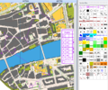
 Export Courses KMZ.PNG 1,921 × 994; 2.69 MB
 ExportedCourse.PNG 706 × 586; 119 KB
 ExtractCliffFeatures.png 650 × 364; 160 KB
 ExtractCliffFeatures2.png 650 × 369; 267 KB
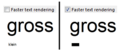 FasterTextRendering.PNG 297 × 129; 6 KB
 FileErrorMessageOCAD11BetaInstallation.png 478 × 171; 18 KB
 FileFolderPuzzleO.PNG 296 × 281; 7 KB
 Fill.gif 724 × 416; 957 KB
 FillBoundedArea.gif 637 × 404; 1.89 MB
 FillBoundedAreasLimits.png 340 × 208; 29 KB
 FillTool.PNG 28 × 28; 590 bytes
 FilledCircleTool.PNG 28 × 28; 507 bytes
 FilledRectangleTool.PNG 28 × 28; 394 bytes
 FindObjectDialog.PNG 340 × 174; 16 KB
 FindSelectedObjects.gif 824 × 584; 933 KB
 FindUTMZone.PNG 338 × 219; 20 KB
 Find Objects.gif 570 × 512; 2.81 MB
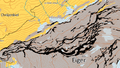
 Finnland.gif 22 × 15; 892 bytes
 FirstAidPoint.png 24 × 24; 168 bytes
 FirstAidPoint Example.png 200 × 120; 34 KB
 FirstFreeCode.png 24 × 24; 218 bytes
 Firstpoint.GIF 14 × 13; 845 bytes
 Following Existing Objects.gif 826 × 582; 6.03 MB
 Framecol.gif 194 × 53; 1 KB
 FramingModeLine.PNG 609 × 117; 9 KB
 FramingModeOff.PNG 609 × 62; 4 KB
 FramingModeShadow.PNG 609 × 70; 7 KB
 Frankreich.gif 22 × 15; 902 bytes
 FreehandModeforTablet.png 600 × 400; 225 KB
 Freehand ExportPDF Settings.gif 251 × 427; 8 KB
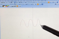
 Freehand To Curve.PNG 416 × 198; 9 KB
 FullLine.PNG 624 × 39; 2 KB
 FullLine MainLine.PNG 473 × 448; 26 KB
 FullStopHelp.PNG 608 × 342; 14 KB
 Fullline.gif 289 × 13; 936 bytes
 FunnelTapes.png 77 × 19; 683 bytes
 FunnelTapesExample.png 236 × 46; 5 KB
 GIS AddTextsByRecords.PNG 505 × 403; 25 KB
 GIS AssignSymbolByRecords.PNG 442 × 422; 27 KB
 GIS ImportShapeFiles.PNG 463 × 713; 40 KB
 GIS Symbolsset.PNG 1,073 × 808; 60 KB
 GPS Orienteering Logo.png 72 × 72; 6 KB
 GUI.JPG 1,402 × 912; 249 KB
 GeneralizeBuildings.PNG 520 × 502; 22 KB
 GenerateMapPreview.PNG 23 × 23; 3 KB
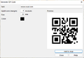 GenerateQrCode.png 544 × 371; 13 KB
 GenerateQrCodeExample.png 580 × 300; 61 KB
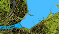 Geneva.png 700 × 400; 216 KB
 GeoPackageImport1.png 656 × 268; 10 KB
 GeoPackageImport2.png 662 × 296; 11 KB
 GeoPackageImport3.png 824 × 255; 8 KB
 Geolog.gif 296 × 48; 1 KB
 GeologicalLine.PNG 625 × 89; 5 KB
 GeologicalLine Decrease.PNG 471 × 452; 21 KB
 GeologicalLine Distances.PNG 476 × 447; 25 KB
 GeologicalLine SymbolEditorA.PNG 398 × 399; 10 KB
 GeologicalLine SymbolEditorB.PNG 401 × 398; 10 KB
 GeologicalLine Symbols.PNG 470 × 450; 25 KB
 GeoreferencedNonGeoreferencedMap.png 866 × 246; 445 KB
 GetObjects.PNG 876 × 675; 280 KB
 GetObjectsFromCurrentView.PNG 23 × 23; 3 KB
 GhostscriptFilePath.png 597 × 251; 8 KB
 GhostscriptFilePathNew.png 386 × 57; 2 KB
 GoogleMapsLayers.png 787 × 229; 298 KB
 GoogleMapsUncheckLabels.png 812 × 218; 225 KB
 GoogleStreetView.jpg 754 × 659; 175 KB
 GoogleStreetViewDragDirection.png 293 × 373; 31 KB
 GpsInterfaceLocationApi.png 405 × 111; 6 KB
 GpsRealTimeShowTail.png 573 × 279; 15 KB
 GpsRealTimeThickerCursor.png 627 × 382; 19 KB
 GpsViaSmartphone.png 177 × 233; 18 KB
 Gradient.PNG 417 × 210; 15 KB
 Graphicmodifications.gif 700 × 500; 1.14 MB
 Grossbritanien.gif 22 × 11; 1 KB
 GroupUngroup.png 447 × 134; 8 KB
 HTTP.png 397 × 114; 5 KB
 Hatch.PNG 417 × 379; 30 KB
 HatchAreas.PNG 1,068 × 814; 121 KB


