Online Map Services: Difference between revisions
Jump to navigation
Jump to search
No edit summary |
No edit summary |
||
| Line 10: | Line 10: | ||
[[File:OnlineMapServicesResolution.png]] | [[File:OnlineMapServicesResolution.png]] | ||
Click '''OK'''. | Click '''OK'''. OCAD loads this screenshot and change to [[View_Mode#Draft_Mode|Draft mode]]. | ||
[[File:OnlineMapServicesBackgroundMap.png]] | |||
Choose '''Adjust''' in the '''Background Map''' menu to adjust this screenshot. | |||
Revision as of 17:26, 23 February 2017
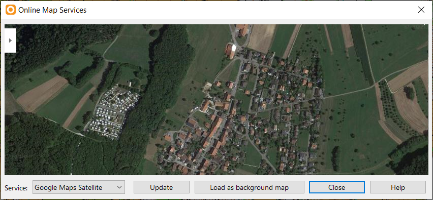
Choose this command from the Background Map menu to load temporary a screenshot from Google Maps as background map.
If the map is geo-referenced, OCAD opens Google Maps at the same location. Move and zoom in Google Maps to the desired location. You can also enlarge the Online Map Services dialog by clicking and dragging a corner.
Click Load as background map to make a screenshot and load this map as background map. The Background Map dialog appears. The screenshot is not geo-referenced.
Click OK. OCAD loads this screenshot and change to Draft mode.
Choose Adjust in the Background Map menu to adjust this screenshot.


