MapAnt: Difference between revisions
No edit summary |
|||
| (12 intermediate revisions by 3 users not shown) | |||
| Line 1: | Line 1: | ||
[[File:MapAnt.png]] | [[File:MapAnt CH.png]] | ||
==What is MapAnt Switzerland== | ==What is MapAnt Switzerland== | ||
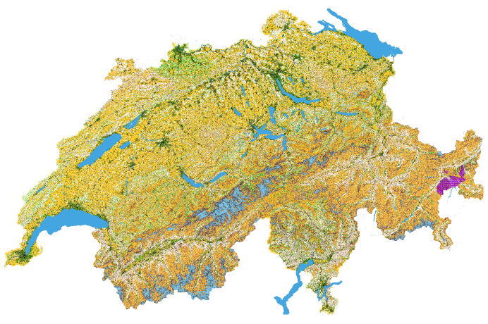
'''[https://www.mapant.ch MapAnt Switzerland]''' is an automatically generated orienteering map, which | '''[https://www.mapant.ch MapAnt Switzerland]''' is an automatically generated orienteering map, which covers the whole of Switzerland.<br> | ||
==How was MapAnt created?== | ==How was MapAnt created?== | ||
The map | The map itself for MapAnt Switzerland was created with OCAD. | ||
Large amounts of | Large amounts of elevation data were imported via '''[[XML_Script_Lidar_and_DTM_Import|XML script LiDAR and DTM Import]]''' to derive contour lines and a vegetation map. | ||
Also, data from the | Also, data from the large-scale topographic landscape model of Switzerland were imported and converted into OCAD symbols. | ||
Afterwards, WMTS tiles were exported | Afterwards, WMTS tiles were exported in OCAD using '''[[XML_Script_WMTS_Export|XML Script WMTS Export]]''' and made available on the web with '''[https://leafletjs.com/ leaflet]'''. | ||
== | ==Data source== | ||
Most of the data was obtained from ''Bundesamt für Landestopografie swisstopo''. | |||
''Contour lines'': [https://www.swisstopo.admin.ch/de/geodata/height/alti3d.html swissALTI3D]<br> | |||
''Vegetation map'': [https://www.swisstopo.admin.ch/de/geodata/height/surface3d.html swissSURFACE3D]<br> | |||
''Topographic landscape model'': [https://www.swisstopo.admin.ch/de/geodata/landscape/tlm3d.html swissTLM3D] | |||
However, for some cantons ''swisstopo'' does not yet provide swissSURFACE3D data to calculate a vegetation map.<br> | |||
For cantons ''Bern, Basel, Baselland'' and ''Solothurn'', these data could be obtained from the cantonal authorities.<br> | |||
For cantons ''Graubünden (Grisons), Wallis (Valais)'' and ''Jura'', no data could be obtained and therefore the vegetation map is missing in these cantons. | |||
==How to use MapAnt?== | ==How to use MapAnt?== | ||
MapAnt can animate to discover new areas, you can load it as a background map for mapping or print parts of it for training.<br> | |||
[[File:Achtung.PNG|15px]] | MapAnt can animate to discover new areas, you can load it as a background map for mapping or print parts of it for training. The individual tiles of mapant.ch can be exported georeferenced as 1x1km or 16x16km tiles georeferenced and later loaded e.g., as background map in OCAD.<br> | ||
In OCAD, you can also load mapant.ch directly as a predefined '''[[WMS#Connect_to_a_WMS_.2F_WMTS_Server|WMTS]]''' layer.<br> | |||
'''URL''': https://www.mapant.ch/WMTSCapabilities.xml | |||
[[File:MapAnt WMTS.PNG|700px]] | |||
[[File:Achtung.PNG|15px]]Please note, that the possession of this map does not entitle to any orienteering activities in the terrain. Before using this map in the terrain, it is mandatory to contact the [https://www.swiss-orienteering.ch/de/verband/vereine.html local orienteering club or the regional orienteering association] to clarify forest use, private property, nature reserves, wildlife reserves, protected areas and other restrictions. | |||
MapAnt kann zum entdecken neuer Gebiete animieren, man kann es als Hintergrundkarte zum kartieren laden oder Teile davon für Trainings ausdrucken.<br> | MapAnt kann zum entdecken neuer Gebiete animieren, man kann es als Hintergrundkarte zum kartieren laden oder Teile davon für Trainings ausdrucken.<br> | ||
[[File:Achtung.PNG|15px]] | [[File:Achtung.PNG|15px]]Bitte beachtet aber, dass der Besitz dieser Karte nicht automatisch zu irgendwelchen OL-Aktivitäten im Gelände berechtigt. Vor einer Benützung dieser Karte im Gelände ist zwingend der [https://www.swiss-orienteering.ch/de/verband/vereine.html lokale OL-Verein oder der regionale OL-Verband] zu kontaktieren, um Waldnutzung, Privatbesitz, Naturschutzgebiete, Wildruhezonen, Schutzgebiete und weitere Einschränkungen abzuklären. | ||
Likewise, mapant.ch can be integrated as WMTS in [https://map.geo.admin.ch map.geo.admin.ch]. | |||
[[File:MapAnt MapGeoAdmin.png|700px]] | |||
==Credits== | ==Credits== | ||
MapAnt Switzerland was supported by [https://www.goennerclub.ch/ OL Gönnerclub] and [http://rolv-nws.ch/ ROLV NWS].<br> | MapAnt Switzerland and its pilot project [https://www.mapant.ch/NWS MapAnt NWS] was supported by [https://www.goennerclub.ch/ OL Gönnerclub] and [http://rolv-nws.ch/ ROLV NWS]. | ||
Also, MapAnt Switzerland was inspired by various similar projects worldwide, most notably [https://www.mapant.fi MapAnt Finland] and [https://mapant.no/ MapAnt Norway].<br> Thanks for the idea and willingness to share knowledge. | <br> | ||
Also, MapAnt Switzerland was inspired by various similar projects [https://mapant.net/ worldwide], most notably [https://www.mapant.fi MapAnt Finland] and [https://mapant.no/ MapAnt Norway].<br> Thanks for the idea and willingness to share knowledge. | |||
==Map Extracts== | |||
[[File:Matterhorn.png]]<BR>(Half of the) Matterhorn | |||
[[File:Hundschopf.png]]<BR>Hundschopf (Lauberhorn downhill ski race) | |||
[[File:Chuenisbärgli.png]]<BR>Chuenisbärgli (Adelboden ski races) | |||
[[File:CreuxDuVan.png]]<BR>Creux du Van | |||
[[File:Geneva.png]]<BR>Geneva | |||
[[File:Aletsch Glacier.png]]<BR>Aletsch Glacier | |||
==Imprint== | ==Imprint== | ||
Latest revision as of 15:40, 30 March 2022
What is MapAnt Switzerland
MapAnt Switzerland is an automatically generated orienteering map, which covers the whole of Switzerland.
How was MapAnt created?
The map itself for MapAnt Switzerland was created with OCAD.
Large amounts of elevation data were imported via XML script LiDAR and DTM Import to derive contour lines and a vegetation map.
Also, data from the large-scale topographic landscape model of Switzerland were imported and converted into OCAD symbols.
Afterwards, WMTS tiles were exported in OCAD using XML Script WMTS Export and made available on the web with leaflet.
Data source
Most of the data was obtained from Bundesamt für Landestopografie swisstopo.
Contour lines: swissALTI3D
Vegetation map: swissSURFACE3D
Topographic landscape model: swissTLM3D
However, for some cantons swisstopo does not yet provide swissSURFACE3D data to calculate a vegetation map.
For cantons Bern, Basel, Baselland and Solothurn, these data could be obtained from the cantonal authorities.
For cantons Graubünden (Grisons), Wallis (Valais) and Jura, no data could be obtained and therefore the vegetation map is missing in these cantons.
How to use MapAnt?
MapAnt can animate to discover new areas, you can load it as a background map for mapping or print parts of it for training. The individual tiles of mapant.ch can be exported georeferenced as 1x1km or 16x16km tiles georeferenced and later loaded e.g., as background map in OCAD.
In OCAD, you can also load mapant.ch directly as a predefined WMTS layer.
URL: https://www.mapant.ch/WMTSCapabilities.xml
Please note, that the possession of this map does not entitle to any orienteering activities in the terrain. Before using this map in the terrain, it is mandatory to contact the local orienteering club or the regional orienteering association to clarify forest use, private property, nature reserves, wildlife reserves, protected areas and other restrictions.
MapAnt kann zum entdecken neuer Gebiete animieren, man kann es als Hintergrundkarte zum kartieren laden oder Teile davon für Trainings ausdrucken.
Bitte beachtet aber, dass der Besitz dieser Karte nicht automatisch zu irgendwelchen OL-Aktivitäten im Gelände berechtigt. Vor einer Benützung dieser Karte im Gelände ist zwingend der lokale OL-Verein oder der regionale OL-Verband zu kontaktieren, um Waldnutzung, Privatbesitz, Naturschutzgebiete, Wildruhezonen, Schutzgebiete und weitere Einschränkungen abzuklären.
Likewise, mapant.ch can be integrated as WMTS in map.geo.admin.ch.
Credits
MapAnt Switzerland and its pilot project MapAnt NWS was supported by OL Gönnerclub and ROLV NWS.
Also, MapAnt Switzerland was inspired by various similar projects worldwide, most notably MapAnt Finland and MapAnt Norway.
Thanks for the idea and willingness to share knowledge.
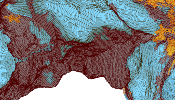
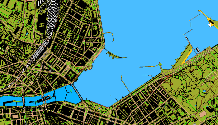
Map Extracts
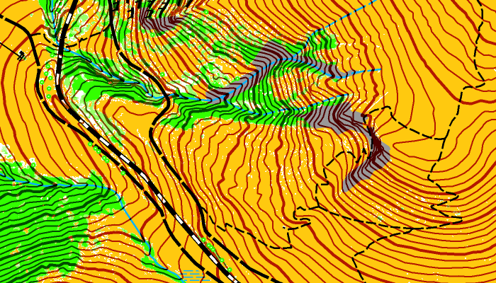
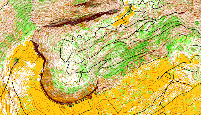
Hundschopf (Lauberhorn downhill ski race)
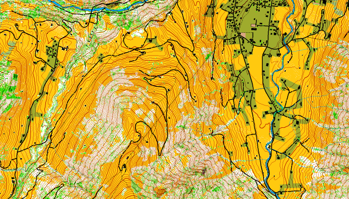
Chuenisbärgli (Adelboden ski races)
Imprint
OCAD AG
Mühlegasse 36
CH-6340 Baar / Switzerland
E-Mail: info@ocad.com
Persons authorized to represent the company
Thomas Gloor, Delegate of the Board of Directors
Central Business Name
Business name: OCAD AG
UID: CHE-112.351.352
Commercial Registry Office: Baar
VAT Number: CHE-112.351.352
VAT number EU: EU276001468
