
Calculate smoothed contour lines with OCAD
Novel technology
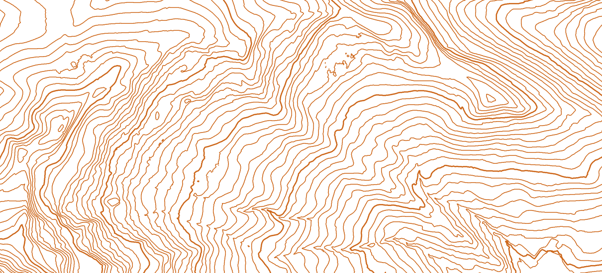
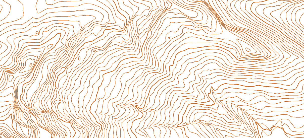
OCAD can be used to generate smoothed contour lines. This is made possible by the inclusion of the Topographic Position Index (TPI) in combination with 3D smoothing of the terrain. The strength of the contour smoothing is automatically adapted to the level of detail of the terrain. This leads to improved results compared to conventional contour lines. The terrain is rendered smoothly and accurately.
Large areas in one step
Thanks to XML scripts, huge amounts of data can be calculated at once. Along the tile boundaries, the data of neighboring tiles are aligned so that the contour lines are continuous beyond the tile boundaries. To keep the file size as small as possible, irrelevant vertices are removed and the contour lines are converted to Bézier curves.
OCAD, ready to go
In no time at all you have OCAD installed and can get started yourself.
OCAD, developed by cartographers for cartographers
OCAD is constantly updated to reflect the latest developments in cartography. You will receive professional support from OCAD experts in cartography and technical support.
Our Services
Calculation and supply of smoothed contour lines
We deliver smoothed 0.5m or 1m contour lines for small or large areas. The delivery takes place as DXF and Shape in 1x1km tiles.
Training
Our OCAD experts are happy to teach you everything you need to work independently with OCAD.
Our Software
Worldwide use
OCAD is a vector graphics program for drawing togographic maps or various types of plans. The software program was originally developed for the creation of orienteering maps. Today it is successfully used in all areas of professional cartography.
Ongoing development
OCAD has been continuously developed according to customer requirements for 30 years. At the headquarters of OCAD AG in Baar, Switzerland, there are 7 employees who stand up for our credo: “We do whatever it takes to make your maps perfect”.
Our References

Canton of Zug
The canton of Zug needed newly calculated 1m contour lines (or 0.5m in flat areas) from the swissALTI3D data,
in order to provide them to third parties.

Canton of Schwyz
Smoothed contour lines with 1m equidistance were calculated from 1003 laz tiles of the product swissSURFACE3D, tile size 1 km x 1 km.
OCAD Trial
Try OCAD Full Version for free.
Please register to request the trial version.