Help
Uploads by GRS
Jump to navigation
Jump to search
This special page shows all uploaded files.
File list
Items per page:
20
50
100
250
500
Username:
Include old versions of files
Go
First page
Previous page
Next page
Last page
Date
Name
Thumbnail
Size
Description
Versions
10:04, 28 November 2012
Mark Color GpsCursor.PNG
(
file
)
255 bytes
1
14:38, 2 August 2016
ImportShapeFileOrienteeringViewTable.PNG
(
file
)
262 bytes
1
13:58, 21 May 2013
LargeSquareCross.png
(
file
)
337 bytes
1
16:41, 27 July 2016
ExportKmzGarminCustomMapsTiles.png
(
file
)
690 bytes
1
12:39, 28 November 2017
Std40px.PNG
(
file
)
704 bytes
2
14:26, 14 September 2012
BackgroundMapsInfoLock.png
(
file
)
707 bytes
1
14:25, 14 September 2012
BackgroundMapsInfoIcon.png
(
file
)
710 bytes
1
10:03, 28 November 2012
Mark Color.PNG
(
file
)
834 bytes
1
16:09, 16 May 2017
LidarPointCloudManager PointCloud SymbolBox.png
(
file
)
1 KB
1
14:56, 16 May 2017
LidarPointCloudManager PointCloud Classification HeightAboveGround.png
(
file
)
1 KB
1
14:17, 26 July 2017
SymbolSetConversion SymbolBox.png
(
file
)
2 KB
1
12:26, 18 February 2016
DemShowFrameStatusBar.png
(
file
)
2 KB
1
14:51, 16 May 2017
LidarPointCloudManager PointCloud Classification ReturnTypes.png
(
file
)
2 KB
1
15:02, 1 May 2013
ExportPdfExampleSpotColorsYellow.png
(
file
)
2 KB
1
15:00, 1 May 2013
ExportPdfExampleSpotColorsBlue.png
(
file
)
3 KB
1
18:56, 7 November 2017
ChangeScale.PNG
(
file
)
3 KB
2
10:18, 28 November 2012
Mark Color HighContrast.PNG
(
file
)
3 KB
1
16:07, 16 May 2017
LidarPointCloudManager PointCloud ImportOptions.png
(
file
)
3 KB
1
10:04, 28 November 2012
Mark Color Drawing.PNG
(
file
)
3 KB
1
16:22, 16 May 2017
LidarPointCloudManager PointCloud Symbols.png
(
file
)
4 KB
2
11:31, 30 December 2016
DirectAreaObjectCCW.png
(
file
)
4 KB
1
14:50, 13 May 2016
BlendModeOcad.png
(
file
)
4 KB
2
15:01, 1 May 2013
ExportPdfExampleSpotColorsGreen.png
(
file
)
4 KB
1
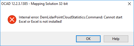
13:51, 19 May 2017
LidarPointCloudManagerStatisticsExcelErrorMessage.png
(
file
)
4 KB
1
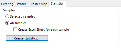
16:25, 16 May 2017
LidarPointCloudManager Statistics.png
(
file
)
4 KB
1
16:20, 5 April 2016
AlsDataImport 1.png
(
file
)
5 KB
1
15:13, 29 August 2016
NonGeoreferencedRasterMap.png
(
file
)
5 KB
1
09:44, 29 August 2016
MoveParallelWithDistance DialogBox.PNG
(
file
)
5 KB
2
16:36, 19 February 2016
Ocad12TrialErrorMessageCodeSigning1.png
(
file
)
5 KB
1
17:20, 23 February 2017
OnlineMapServicesResolution.png
(
file
)
5 KB
1
14:49, 13 May 2016
BlendModePdf.png
(
file
)
5 KB
1
16:22, 5 April 2016
AlsDataImport 2.png
(
file
)
5 KB
1
17:21, 17 February 2017
LicenseActivation.png
(
file
)
6 KB
2
18:43, 28 February 2013
ContourLinesSplitted.PNG
(
file
)
6 KB
1
09:14, 31 August 2017
ConvertToImageObjectExample.PNG
(
file
)
7 KB
1
10:55, 7 February 2017
CoordinateSystemDialog.PNG
(
file
)
7 KB
3
14:42, 1 May 2013
ExportPdfExampleNormalView.png
(
file
)
7 KB
1
14:44, 1 May 2013
ExportPdfExampleSpotColorView.png
(
file
)
7 KB
1
15:00, 1 May 2013
ExportPdfExampleSpotColorsBlack.png
(
file
)
7 KB
1
14:28, 26 July 2017
SymbolSetConversion OptimizeRepair.png
(
file
)
7 KB
1
14:05, 26 July 2017
SymbolSetConversion ObjectsAssigned.png
(
file
)
7 KB
2
17:01, 17 February 2017
LicenseTransferUtility.png
(
file
)
7 KB
1
16:36, 14 September 2016
BackgroundMapOpenPdfLoadedJpg.png
(
file
)
8 KB
1
16:25, 14 September 2016
GhostscriptFilePath.png
(
file
)
8 KB
1
13:30, 26 July 2017
SymbolSetConversion ListGreen.png
(
file
)
9 KB
1
11:21, 10 August 2016
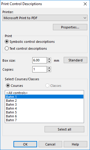
PrintControlDescriptionPdf.png
(
file
)
9 KB
1
15:00, 1 May 2013
ExportPdfExampleCMYK.png
(
file
)
9 KB
1
16:09, 30 October 2015
AssignNewSymbolWhenChangingFieldValue2.png
(
file
)
9 KB
1
11:20, 12 September 2016
BackgroundMapsManagerWms.png
(
file
)
9 KB
1
15:17, 9 August 2016
Update2.PNG
(
file
)
10 KB
4
First page
Previous page
Next page
Last page
Navigation menu
Personal tools
Log in
Namespaces
Special page
English
expanded
collapsed
Views
More
expanded
collapsed
Search
Navigation
Main page
Visit ocad.com
Recent changes
Help
Tools
User contributions
Logs
View user groups
Special pages


