Control Elevation
Jump to navigation
Jump to search
(This function is only available in course setting projects!)
Control elevation is used to calculate the height climb for courses. This function doesn't work for relay courses.
Choose the Control Elevation command in the Controls submenu of the Course Setting menu to change the elevation of a control.
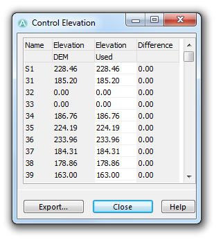
The Control Elevation dialog box is displayed. It shows a table with four columns:
- Name: In this column the control code is displayed.
- Elevation DEM: This column shows the elevation of the control calculated with help of the DEM. If no DEM is loaded, this column is empty.
- Elevation Used: In this column an elevation value can be entered if there is no DEM available or if elevation DEM value is not correct. If a value is entered in this column, it is used for courses' height climb calculation.
- Difference: The difference between the Elevation DEM and the Elevation Used columns is displayed here.
Click the Close button to quit this dialog. Click the Export button to export the table as a XLS, TXT, HTM or DOC-File.
Back to the Course Setting for Orienteering page.
