WMS: Unterschied zwischen den Versionen
Zur Navigation springen
Zur Suche springen
Keine Bearbeitungszusammenfassung |
Admin (Diskussion | Beiträge) Keine Bearbeitungszusammenfassung |
||
| Zeile 14: | Zeile 14: | ||
[[File:WMS2.png]] | [[File:WMS2.png]] | ||
'''Close''' the dialog box. | '''Close''' the dialog box. You can manage the view by choosing '''Manage''' from the '''Background Map''' menu. | ||
[[File:WMS3.png]] | [[File:WMS3.png]] | ||
One possibility to display the map: | |||
[[File:WMS4.png]] | [[File:WMS4.png]] | ||
Version vom 21. November 2011, 14:50 Uhr
![]() First choose Scale and Coordinate System from the Map menu to set the map scale.
First choose Scale and Coordinate System from the Map menu to set the map scale.
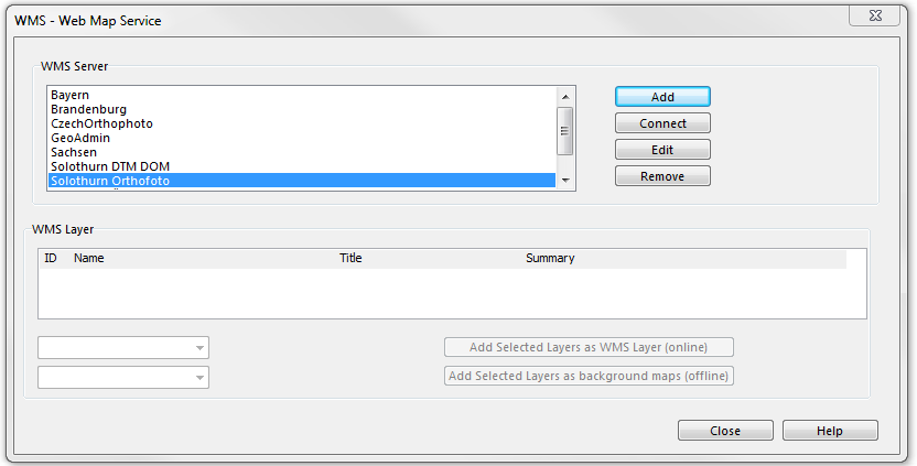
Choose WMS - Web Map Service from Background Map menu.
Add a WMS Server and click Connect.
Choose a WMS Layer from the list and Add Selected Layer as WMS Layer (online) or Add Selected Layer as background maps (offline).
Close the dialog box. You can manage the view by choosing Manage from the Background Map menu.
One possibility to display the map:


