Nicht kategorisierte Dateien
Zur Navigation springen
Zur Suche springen
Unten werden bis zu 500 Ergebnisse im Bereich 1 bis 500 angezeigt.
Zeige (vorherige 500 | nächste 500) (20 | 50 | 100 | 250 | 500)
 11-PreferencesGUIContextMenu.gif 228 × 184; 4 KB
 1 Rancate130x130.gif 130 × 130; 11 KB
 2 Geotopo Flims130x130.gif 130 × 130; 9 KB
 3 Activation ENG.PNG 654 × 573; 36 KB
 3 Activation GER.PNG 654 × 573; 36 KB
 3 Stockholm130x130.gif 130 × 130; 13 KB
 6 BerlinFriedrichshain130x130.gif 130 × 130; 12 KB
 7 Koepenick130x130.gif 130 × 130; 12 KB
 AddControlDescriptionHelp.PNG 527 × 427; 19 KB
 AddTextsbyRecordsExample.PNG 922 × 270; 142 KB
 AddWMSServer.PNG 561 × 306; 24 KB
 AdjustGPS.PNG 415 × 308; 14 KB
 AlignHorizontally.PNG 760 × 404; 13 KB
 AlignVertically.PNG 962 × 404; 14 KB
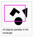
 AllObjects.JPG 133 × 114; 11 KB
 AllObjects.PNG 151 × 169; 13 KB
 AnchorPoint.JPG 18 × 20; 8 KB
 AntiAliasingExample.PNG 711 × 186; 68 KB
 AppleLogo.JPG 250 × 306; 8 KB
 AreaBoundary.PNG 626 × 84; 4 KB
 AreaBoundary Distances.PNG 495 × 476; 29 KB
 AreaBoundary MainLine.PNG 489 × 463; 22 KB
 AreaBoundary SymbolEditor.PNG 407 × 407; 9 KB
 AreaBoundary SymbolEditor 02.PNG 257 × 254; 8 KB
 AreaSymbol.JPG 388 × 353; 33 KB
 Areabtn.gif 23 × 22; 893 Bytes
 AssignSymbolsByRecords.PNG 456 × 436; 29 KB
 Autocontroldescriptioncontourgrad.gif 180 × 178; 5 KB
 Avenue.png 750 × 155; 20 KB
 Back.JPG 32 × 22; 8 KB
 BackgroundMap.JPG 835 × 341; 40 KB
 BackgroundMap.png 835 × 341; 19 KB
 BackgroundMapDialogGeoreferenced.PNG 512 × 539; 41 KB
 BackgroundMapsInfoIcon.png 18 × 18; 710 Bytes
 BackgroundMapsInfoLock.png 18 × 18; 707 Bytes
 BackupAndRestoreOptions.png 451 × 181; 19 KB
 Bahnen.PNG 908 × 369; 43 KB
 BahnobjektEinfügen.PNG 492 × 430; 36 KB
 BahnobjektVonMehrerenBahnenLöschen.PNG 451 × 684; 42 KB
 BahnobjektZuMehrerenBahnenHinzufügen.PNG 430 × 655; 40 KB
 BetaRunAsAdministrator.png 717 × 545; 71 KB
 BezierCurveEditVertex.PNG 259 × 122; 2 KB
 BlackSquare.PNG 13 × 11; 153 Bytes
 Blockout.PNG 846 × 362; 76 KB
 BolderWithShrubbery.PNG 974 × 233; 16 KB
- Book icoline.svgBook icoline.svg Datei fehlt
 Bookmarks.PNG 492 × 434; 69 KB
 Border.PNG 688 × 337; 12 KB
 BoulderWithShrubbery Structure.PNG 391 × 360; 18 KB
 BoulderWithShrubbery SymbolEditor.PNG 510 × 522; 27 KB
 BoxSizeHelp.PNG 599 × 416; 30 KB
 COM.png 409 × 112; 6 KB
 CRTFile.PNG 393 × 434; 11 KB
 CS40px.PNG 40 × 20; 477 Bytes
 CableCar.PNG 626 × 80; 5 KB
 CableCar Distances.PNG 506 × 493; 29 KB
 CableCar Framing.PNG 508 × 485; 25 KB
 CableCar MainLine.PNG 496 × 469; 31 KB
 CableCar SymbolEditor.PNG 407 × 406; 9 KB
 CalculateDEMDifference.PNG 421 × 187; 21 KB
 CalculateSlopeGradient.PNG 557 × 271; 26 KB
 Camera.jpg 22 × 15; 487 Bytes
 CantonBoundary.PNG 627 × 110; 7 KB
 CantonBoundary Distances.PNG 479 × 474; 25 KB
 CantonBoundary SymbolEditor.PNG 405 × 406; 10 KB
 Cascade.PNG 1.120 × 879; 229 KB
 Cdcontrol1.gif 26 × 26; 923 Bytes
 Cdstart.gif 24 × 24; 917 Bytes
 Cdsymbol.gif 24 × 24; 893 Bytes
 CenterMapToDrawingArea.png 1.159 × 871; 43 KB
 ChangeControlDescriptionType.png 547 × 197; 10 KB
 ChangeCoordinateSystem.PNG 343 × 328; 25 KB
 ChangeScale.PNG 333 × 201; 17 KB
 Change To Bezier.PNG 609 × 459; 57 KB
 Change To Bezier Example.PNG 1.740 × 168; 14 KB
 Change To Polyline Example.PNG 1.740 × 168; 13 KB
 CharacterSpacing.PNG 648 × 90; 11 KB
 CheckInSelectedObjects.PNG 23 × 23; 3 KB
 CheckOutSelectedObjects.PNG 23 × 23; 3 KB
 CheckedOutObjects.PNG 709 × 458; 44 KB
 CircleSymbole.JPG 22 × 20; 8 KB
 Circlebtn.gif 23 × 22; 902 Bytes
 ClassifiedDifferenceDEM.PNG 898 × 898; 1,13 MB
 ClientServerToolbar.PNG 464 × 54; 6 KB
 Close Area Objects When Drawing.PNG 663 × 302; 9 KB
 ColorDialog.PNG 826 × 491; 60 KB
 ColorDialogHiddenColumns.png 825 × 493; 60 KB
 ColorPicker.png 363 × 687; 46 KB
 ColorSwatch.png 1.017 × 237; 45 KB
 ColorSwatchIdentical.png 1.007 × 358; 61 KB
 ColorSwatchOrange.png 1.001 × 358; 53 KB
 Colors.PNG 783 × 18; 1 KB
 Colors.jpg 992 × 709; 107 KB
 Colors Minor Road.PNG 349 × 88; 1 KB
 Colors Motorway.PNG 414 × 223; 3 KB
 CompatibilityCheck.png 508 × 270; 26 KB
 ConnectDisconnect.PNG 23 × 23; 3 KB
 ConnectToLaserDistanceMeter.png 472 × 237; 17 KB
 ConstructionMode.JPG 21 × 23; 8 KB
 ConstructionModeTerangle.JPG 23 × 24; 8 KB
 ContextMenu.png 230 × 161; 4 KB
 ContourLines.PNG 519 × 559; 49 KB
 ContourLinesSplitted.PNG 353 × 361; 6 KB
 ControlDescriptionBlockout.png 489 × 291; 36 KB
 ControlDescriptionDeclaration.PNG 428 × 110; 4 KB
 ControlDescriptionDraftMode.png 995 × 354; 86 KB
 ControlDescriptionHowTo.PNG 503 × 197; 18 KB
 ControlElevation.PNG 316 × 343; 28 KB
 ControlNumberFraming.png 699 × 536; 107 KB
 ConvertAreaOrLineObjectsToPointObjects.PNG 449 × 218; 22 KB
 ConvertTextObjectsToPointObjects.PNG 449 × 541; 19 KB
 ConvertToGraphicObject.PNG 768 × 344; 63 KB
 ConvertToGraphicObjectExample.PNG 488 × 538; 11 KB
 ConvertToLayoutObject.PNG 659 × 300; 35 KB
 CoordinateSystemDialog.PNG 568 × 351; 30 KB
 CopyTool.PNG 28 × 28; 545 Bytes
 CornerRadius.PNG 503 × 317; 7 KB
 CornerSymbol.PNG 644 × 287; 9 KB
 CourseObjectDialogBox.PNG 398 × 205; 19 KB
 CourseOptions.PNG 815 × 477; 64 KB
 CourseSetting.PNG 120 × 45; 1 KB
 CourseSettingDialog.PNG 846 × 507; 65 KB
 CourseSettingExample.PNG 909 × 383; 140 KB
 CourseTitleHelp.PNG 796 × 295; 14 KB
 Coursetitle.gif 24 × 24; 915 Bytes
 CreateACornerVertexInABezierCurve.PNG 187 × 174; 7 KB
 CreateADesiredSector.png 476 × 350; 62 KB
 CreateAHole.png 476 × 352; 181 KB
 CreateContourLines.png 649 × 288; 30 KB
 CreateGridLine.PNG 449 × 397; 23 KB
 CreateHillShading.PNG 603 × 326; 29 KB
 CreateHypsometricMap.PNG 479 × 220; 22 KB
 CreateMapGrid.PNG 504 × 355; 22 KB
 CreateNameIndex.PNG 919 × 696; 259 KB
 CreateNameIndexDialog.PNG 397 × 543; 33 KB
 CreateNewProjectBaseProject.PNG 467 × 599; 29 KB
 CreateNewProjectDialog.PNG 468 × 610; 38 KB
 CreateObjectsFromTable.PNG 432 × 399; 24 KB
 CreateObjectsFromTableExample.PNG 883 × 185; 11 KB
 CreateandUpdateRecords.PNG 333 × 181; 18 KB
 CropGradient.png 417 × 210; 7 KB
 CrossReferenceTable.PNG 403 × 355; 12 KB
 CsBox.PNG 259 × 534; 19 KB
 CsBox GER.PNG 258 × 548; 17 KB
 CsFileNew.PNG 395 × 603; 32 KB
 CsFileNew GER.PNG 430 × 634; 42 KB
 CsRenumberAllControls.PNG 354 × 194; 19 KB
 Csfinish1.gif 27 × 27; 954 Bytes
 Csmandatorypassareas.gif 253 × 32; 1 KB
 Csmandatorypasspoints.gif 253 × 31; 1 KB
 CustomizeToolbars.png 674 × 690; 51 KB
 CutHoleFillHole.PNG 352 × 122; 12 KB
 DBaseTableDialog.PNG 512 × 551; 37 KB
 DEM.jpg 868 × 610; 53 KB
 DEMExport.PNG 480 × 196; 11 KB
 DEMProfile.PNG 978 × 652; 34 KB
 DEMProfileOptions.PNG 628 × 600; 42 KB
 DSM2mHypso.PNG 737 × 737; 568 KB
 DTM5mHypso.PNG 400 × 400; 140 KB
 Dam.PNG 972 × 230; 10 KB
 Dam General.PNG 416 × 379; 28 KB
 Dam Structure.PNG 414 × 381; 25 KB
 Dam SymbolEditor.PNG 396 × 262; 9 KB
 Dashb.gif 289 × 13; 973 Bytes
 Dashdot.gif 289 × 13; 998 Bytes
 DashedCornerVertex.PNG 118 × 135; 4 KB
 DashedFraming.PNG 805 × 100; 8 KB
 DashedFraming Distances.PNG 513 × 468; 25 KB
 DashedFraming DoubleLine.PNG 513 × 479; 26 KB
 DashedFraming Framing.PNG 484 × 468; 20 KB
 DashedFraming MainLine.PNG 476 × 464; 26 KB
 DashedLine.PNG 625 × 90; 6 KB
 DashedLineCorner.PNG 276 × 68; 2 KB
 DashedLineIntersection.PNG 927 × 119; 9 KB
 DashedLineWithBackground.PNG 807 × 89; 7 KB
 DashedLineWithBackground Distances.PNG 495 × 468; 40 KB
 DashedLineWithBackground Framing.PNG 513 × 484; 37 KB
 DashedLineWithBackground MainLine.PNG 505 × 486; 44 KB
 DashedLineWithDots.PNG 623 × 79; 4 KB
 DashedLineWithDots Distances.PNG 499 × 477; 28 KB
 DashedLineWithDots MainLine.PNG 499 × 487; 21 KB
 DashedLineWithDots SymbolEditor.PNG 403 × 400; 10 KB
 DashedLine Distances.PNG 490 × 467; 18 KB
 DashedLine MainLine.PNG 494 × 472; 21 KB
 DashedNormalVertex.PNG 117 × 98; 3 KB
 Dashedline.gif 289 × 15; 992 Bytes
 Database1.PNG 255 × 153; 8 KB
 Database2.PNG 708 × 355; 25 KB
 Database3.PNG 707 × 358; 25 KB
 Database4.PNG 255 × 153; 8 KB
 Database5.PNG 259 × 135; 6 KB
 Database6.PNG 436 × 159; 19 KB
 Database7.PNG 255 × 172; 9 KB
 Database8.PNG 255 × 172; 9 KB
 DatabaseEnginesInstalled.png 504 × 114; 7 KB
 DatabaseNewDataset.PNG 352 × 303; 20 KB
 DatabaseRedo.PNG 23 × 23; 3 KB
 DatabaseUndo.PNG 23 × 23; 3 KB
 Dawdot.gif 289 × 13; 986 Bytes
 Decrease.PNG 630 × 411; 17 KB
 DefineSpotColors.PNG 791 × 546; 40 KB
 DefinedNumberOfObjects.PNG 304 × 131; 11 KB
 DeleteObjectInDatabase.PNG 23 × 23; 3 KB
 DeleteRecordsWithoutLinkedObject.png 541 × 321; 29 KB
 DeleteSelectedObjectsInACertainArea.png 476 × 351; 186 KB
 DemClassifyVegetationHeight.PNG 542 × 513; 38 KB
 DemImportLas.PNG 775 × 635; 56 KB
 DemImportLas MultipleReturn.jpg 567 × 328; 44 KB
 Diamond.JPG 19 × 20; 8 KB
 DistanceFromCircleHelp.PNG 853 × 507; 21 KB
 DistanceFromCircleToNumberHelp.PNG 850 × 405; 18 KB
 DoDatabaseMaintenance.PNG 23 × 23; 3 KB
 Dotbtn.gif 23 × 22; 898 Bytes
 Dotted.gif 289 × 13; 1.013 Bytes
 DottedLine.PNG 624 × 65; 3 KB
 DottedLineCorner.PNG 173 × 72; 1 KB
 DottedLine Distances.PNG 501 × 478; 29 KB
 DottedLine SymbolEditor.PNG 398 × 398; 10 KB
 DoubleLineHint.PNG 441 × 310; 10 KB
 DraftMode.JPG 96 × 28; 9 KB
 DraftModeSlider.png 95 × 26; 476 Bytes
 DraftModeSliders.png 148 × 57; 2 KB
 Draftmodeslider1.gif 135 × 31; 1 KB
 DrawABezierCurve.PNG 615 × 116; 10 KB
 DrawARectangularAreaOrLine.PNG 635 × 150; 21 KB
 DrawAStraightLine.PNG 612 × 125; 11 KB
 DrawAnEllipse.PNG 327 × 103; 7 KB
 DrawObjectsUsingDifferentDrawingModes.PNG 658 × 212; 19 KB
 DrawStairway.png 492 × 176; 20 KB
 DrawingModeHint.PNG 628 × 278; 14 KB
 DrawingModeStairway.PNG 23 × 24; 306 Bytes
 DxfImport1.png 438 × 435; 40 KB
 DxfImport2.png 438 × 436; 39 KB
 EOCDDocumentInfo.PNG 357 × 474; 13 KB
 EchtzeitGpsAbstimmen.png 372 × 264; 8 KB
 EchtzeitGpsBox.png 144 × 165; 5 KB
 EchtzeitGpsEinstellungen.png 551 × 470; 22 KB
 EchtzeitGpsTesten.png 301 × 494; 16 KB
 EditAndDrawingToolbar.JPG 591 × 31; 14 KB
 EditAndDrawingToolbar.png 614 × 66; 3 KB
 EditFunctionsToolbar.PNG 506 × 29; 3 KB
 EditFunctionsToolbar.png 522 × 71; 4 KB
 EditLayoutObjects.jpg 259 × 826; 65 KB
 EditSelection.PNG 428 × 200; 21 KB
 EditTextControlDescription.PNG 880 × 464; 63 KB
 EditToolbar.JPG 324 × 28; 11 KB
 EditVertex.PNG 192 × 139; 5 KB
 EditWMSServerProperties.PNG 568 × 307; 25 KB
 EditWMSServerProperties.png 586 × 321; 26 KB
 EisenbahnAbstaende.png 449 × 426; 14 KB
 EisenbahnDoppellinie.png 449 × 426; 15 KB
 EisenbahnFreistellung.png 449 × 426; 11 KB
 EisenbahnHauptlinie.png 449 × 426; 16 KB
 EllipseTool.PNG 28 × 28; 557 Bytes
 EncryptedOCADFilePassword.PNG 417 × 181; 19 KB
 EndSymbol.PNG 643 × 291; 9 KB
 Ent40px.PNG 40 × 20; 700 Bytes
 EntireMap.JPG 27 × 26; 8 KB
 ErrorInDatabase1.png 654 × 573; 29 KB
 ErrorMessageBorlandEngineInstall.png 377 × 171; 20 KB
 ErrorMessageDbSysDbsLoadFieldsFromTable.png 367 × 161; 9 KB
 ErrorMessageMissingEtzw32dll.PNG 473 × 171; 19 KB
 ErrorMessageOCAD11BetaInstallation.png 478 × 171; 18 KB
 ErrorStringResource.PNG 342 × 171; 12 KB
 ErsterFreierCode.PNG 21 × 20; 375 Bytes
 Event.gif 24 × 24; 914 Bytes
 Example.jpg 17 × 17; 459 Bytes
 Export.PNG 247 × 199; 8 KB
 ExportCourseMaps.png 364 × 549; 26 KB
 ExportCourseMapsPlaceCoursesAtOriginalPosition.png 1.730 × 758; 448 KB
 ExportCourseMapsPlaceCoursesBelowEachOther.png 344 × 988; 186 KB
 ExportCourseMapsPlaceCoursesBesideEachOther.png 1.722 × 308; 221 KB
 ExportEncryptedFile.PNG 383 × 565; 29 KB
 ExportOim.png 251 × 190; 5 KB
 ExportOimAjaxError0.png 240 × 144; 1 KB
 ExportOimAssistant1General.png 642 × 515; 20 KB
 ExportOimAssistant2ZoomLevel.png 642 × 515; 25 KB
 ExportOimAssistant3Layout.png 642 × 515; 31 KB
 ExportOimAssistant4Pois.png 642 × 515; 23 KB
 ExportOimAssistant5PoiSelector1.png 336 × 266; 12 KB
 ExportOimAssistant5PoiSelector2.png 336 × 266; 12 KB
 ExportOimAssistant5PoiSelector3.png 336 × 266; 11 KB
 ExportOimAssistant5PoiSelector4.png 346 × 344; 18 KB
 FasterTextRendering.PNG 297 × 129; 5 KB
 FileErrorMessageOCAD11BetaInstallation.png 478 × 171; 18 KB
 FillTool.PNG 28 × 28; 590 Bytes
 FilledCircleTool.PNG 28 × 28; 507 Bytes
 FilledRectangleTool.PNG 28 × 28; 394 Bytes
 FindObjectDialog.PNG 306 × 151; 13 KB
 FindUTMZone.PNG 338 × 227; 22 KB
 Firstpoint.GIF 14 × 13; 845 Bytes
 Framecol.gif 194 × 53; 1 KB
 FramingModeLine.PNG 609 × 143; 8 KB
 FramingModeOff.PNG 609 × 61; 3 KB
 FramingModeShadow.PNG 609 × 71; 6 KB
 Freehand ExportPDF Settings.gif 251 × 427; 8 KB
 Freehand To Curve.PNG 461 × 189; 8 KB
 FullLine.PNG 624 × 39; 2 KB
 FullLine MainLine.PNG 505 × 484; 42 KB
 FullStopHelp.PNG 608 × 342; 11 KB
 Fullline.gif 289 × 13; 936 Bytes
 GIS AddTextsByRecords.PNG 531 × 446; 37 KB
 GIS AssignSymbolByRecords.PNG 459 × 437; 36 KB
 GIS ImportShapeFiles.PNG 575 × 723; 50 KB
 GIS Symbolsset.PNG 845 × 659; 39 KB
 GUI.JPG 1.000 × 707; 98 KB
 GenerateMapPreview.PNG 23 × 23; 3 KB
 Geolog.gif 296 × 48; 1 KB
 GeologicalLine.PNG 625 × 89; 5 KB
 GeologicalLine Decrease.PNG 496 × 482; 27 KB
 GeologicalLine Distances.PNG 503 × 471; 18 KB
 GeologicalLine SymbolEditorA.PNG 398 × 399; 10 KB
 GeologicalLine SymbolEditorB.PNG 401 × 398; 10 KB
 GeologicalLine Symbols.PNG 491 × 474; 32 KB
 GetObjects.PNG 876 × 675; 280 KB
 GetObjectsFromCurrentView.PNG 23 × 23; 3 KB
 GpsRealTimeThickerCursor.png 627 × 382; 19 KB
 Gradient.PNG 417 × 211; 18 KB
 GroupUngroup.png 447 × 133; 5 KB
 HTTP.png 397 × 115; 5 KB
 Hatch.PNG 406 × 365; 13 KB
 HatchAreas.PNG 1.068 × 814; 121 KB
 HatchAreasExample.PNG 1.024 × 125; 140 KB
 HatchExample.PNG 756 × 167; 6 KB
 HatchTip.PNG 533 × 321; 11 KB
 HeighOnASlope.PNG 109 × 67; 987 Bytes
 Help.gif 763 × 429; 24 KB
 Highway.PNG 808 × 135; 8 KB
 Highway DoubleLine.PNG 484 × 466; 31 KB
 Highway Framing.PNG 489 × 468; 26 KB
 Highway MainLine.PNG 499 × 479; 32 KB
 HillShading.PNG 1.020 × 560; 589 KB
 Hint.jpg 20 × 20; 15 KB
 HintergrundkarteOeffnenGeoreferenziert.png 471 × 499; 27 KB
 HoleWithOnlyTwoVertices.PNG 239 × 183; 3 KB
 HowTos.gif 465 × 360; 48 KB
 HypsometricMap.PNG 1.020 × 565; 226 KB
 IconEditor.JPG 521 × 422; 82 KB
 IconSmooth.PNG 24 × 24; 344 Bytes
 Icon AccuracyCircle.PNG 22 × 22; 344 Bytes
 Icon AddGPSPositionToCalculateAverage.PNG 22 × 22; 384 Bytes
 Icon AlignObjectsHorizontal.PNG 23 × 23; 3 KB
 Icon AlignObjectsVertical.PNG 23 × 23; 3 KB
 Icon AutomaticJoining.PNG 23 × 23; 4 KB
 Icon CSA Redo.PNG 22 × 22; 474 Bytes
 Icon CSA Undo.PNG 22 × 22; 479 Bytes
 Icon ChangeSymbolForAllObjectsWithThisSymbol.PNG 23 × 23; 4 KB
 Icon ChangeSymbolOfObject.PNG 23 × 23; 4 KB
 Icon ChangeToBezierCurve.PNG 23 × 23; 4 KB
 Icon ChangeToPolyline.png 23 × 23; 3 KB
 Icon CheckIn.PNG 22 × 22; 441 Bytes
 Icon CheckOut.PNG 22 × 22; 467 Bytes
 Icon CircleMode.PNG 23 × 23; 4 KB
 Icon ConnectDisconnect.PNG 22 × 22; 363 Bytes
 Icon ConvertToGraphicObject.PNG 23 × 23; 4 KB
 Icon CornerVertex.PNG 23 × 23; 4 KB
 Icon CurveMode.PNG 23 × 23; 4 KB
 Icon Cut.PNG 23 × 23; 4 KB
 Icon CutArea.PNG 23 × 23; 4 KB
 Icon CutHole.PNG 23 × 23; 4 KB
 Icon DashVertex.PNG 23 × 23; 4 KB
 Icon Delete.PNG 23 × 23; 4 KB
 Icon Delete2.PNG 23 × 24; 463 Bytes
 Icon DeleteObjectsInDatabase.PNG 22 × 22; 310 Bytes
 Icon DoDatabaseMaintenance.PNG 22 × 22; 597 Bytes
 Icon DrawingMultiplePointObjects.PNG 23 × 23; 3 KB
 Icon DuplicateObject.PNG 23 × 23; 4 KB
 Icon EllipseMode.PNG 23 × 23; 4 KB
 Icon FillOrMakeBorder.PNG 23 × 23; 4 KB
 Icon FindGPSMarker.PNG 22 × 22; 343 Bytes
 Icon FindSelectedObjects.PNG 23 × 23; 4 KB
 Icon FreehandMode.PNG 23 × 23; 4 KB
 Icon GPSFilter.PNG 22 × 22; 371 Bytes
 Icon GenerateMapPreview.PNG 22 × 22; 542 Bytes
 Icon GetObjectsFromCurrentView.PNG 22 × 22; 592 Bytes
 Icon ImportMap.PNG 22 × 22; 439 Bytes
 Icon IndicateDirectionOfAreaPatternPointOrTextObject.PNG 23 × 23; 4 KB
 Icon InterpolateObjects.PNG 23 × 23; 3 KB
 Icon Join.PNG 23 × 23; 3 KB
 Icon LaserDistance.PNG 23 × 23; 3 KB
 Icon ManageServerBookmarks.PNG 22 × 22; 378 Bytes
 Icon Measure.PNG 23 × 23; 4 KB
 Icon Merge.PNG 23 × 23; 4 KB
 Icon MoveParallel.PNG 23 × 23; 4 KB
 Icon New.PNG 23 × 23; 4 KB
 Icon NormalVertex.PNG 23 × 23; 4 KB
 Icon NumericMode.PNG 23 × 23; 3 KB
 Icon ObjectHistory.PNG 22 × 22; 381 Bytes
 Icon Open.PNG 23 × 23; 4 KB
 Icon OpenRealTimeGPSSettings.PNG 22 × 22; 246 Bytes
 Icon Pan.PNG 22 × 22; 4 KB
 Icon PanLocked.PNG 22 × 23; 4 KB
 Icon PauseGPSMeasurement.PNG 22 × 22; 266 Bytes
 Icon Print.PNG 23 × 23; 4 KB
 Icon RectangularLineMode.PNG 23 × 23; 4 KB
 Icon RectangularMode.PNG 23 × 23; 4 KB
 Icon Redo.PNG 23 × 23; 4 KB
 Icon RemoveVertex.PNG 23 × 23; 4 KB
 Icon Reshape.PNG 23 × 23; 4 KB
 Icon ReverseObject.PNG 23 × 23; 4 KB
 Icon RightsManagement.PNG 22 × 22; 643 Bytes
 Icon RotateEnterAngle.PNG 23 × 23; 3 KB
 Icon RotateObject.PNG 23 × 23; 4 KB
 Icon Save.PNG 23 × 23; 4 KB
 Icon SaveForOfflineWork.PNG 22 × 22; 630 Bytes
 Icon SelectAndEditObject.PNG 23 × 23; 3 KB
 Icon SelectObjectAndEditVertex.PNG 23 × 23; 4 KB
 Icon Setup.PNG 25 × 26; 398 Bytes
 Icon ShowCheckedOutObjects.PNG 22 × 22; 588 Bytes
 Icon ShowEntireMap.PNG 22 × 23; 4 KB
 Icon ShowGrid.PNG 23 × 23; 3 KB
 Icon ShowProjectInformation.PNG 22 × 22; 693 Bytes
 Icon Smooth.PNG 23 × 23; 4 KB
 Icon Snapping.PNG 23 × 23; 4 KB
 Icon StartGPSMeasurement.PNG 22 × 22; 299 Bytes
 Icon StopGPSMeasurement.PNG 22 × 22; 251 Bytes
 Icon StraightLineMode.PNG 23 × 23; 3 KB
 Icon Undo.PNG 23 × 23; 3 KB
 Icon ZoomIn.PNG 22 × 23; 4 KB
 Icon ZoomInLocked.PNG 22 × 23; 4 KB
 Icon ZoomOut.PNG 22 × 23; 4 KB
 Icon ZoomOutToPreviousView.PNG 22 × 23; 4 KB
 Icon ZoomToNextView.PNG 23 × 23; 3 KB
 Icon ZoomToPreviousView.PNG 22 × 23; 4 KB
 ImportFreehandXml.PNG 513 × 311; 28 KB
 ImportMapDialog.PNG 337 × 283; 19 KB
 ImportMaps.PNG 23 × 23; 3 KB
 ImportShapeFile.PNG 500 × 660; 29 KB
 ImportShapeText1.png 872 × 562; 111 KB
 ImportShapeText2.png 493 × 391; 28 KB
 ImportShapeText3.png 872 × 562; 106 KB
 IndentFirstLine.PNG 424 × 283; 11 KB
 IndentOtherLines.PNG 397 × 300; 12 KB
 Index1.gif 120 × 120; 10 KB
 Index2.gif 120 × 120; 12 KB
 Index3.gif 120 × 120; 11 KB
 Index4.gif 120 × 120; 10 KB
 IndicateDirectionofPattern.PNG 607 × 377; 12 KB
 InflectionPointOfBezierCurve.PNG 275 × 174; 9 KB
 InfluenceDashedNormal.PNG 191 × 74; 3 KB
 InfluenceDashedVertex.PNG 199 × 94; 4 KB
 InsertGlyphs.PNG 1.023 × 656; 60 KB
 InsertionLine.PNG 67 × 44; 490 Bytes
 Insertvar.gif 107 × 80; 1 KB
 InternalErrorReadXmlLicenseFile.png 486 × 161; 20 KB
 InternalErrorTOcdIsGridZoneValidUnknownGrid.png 436 × 171; 18 KB
 InterpolateLines.png 525 × 163; 24 KB
 InterpolatePoints.png 731 × 113; 16 KB
 Intersection.PNG 477 × 135; 21 KB
 InvalidExteriorRing.PNG 452 × 184; 7 KB
 Joining Lines.PNG 448 × 501; 8 KB
 KarteOptimierungErgebnis.png 387 × 269; 21 KB
 Kategorien.PNG 663 × 337; 26 KB
 Keyline.PNG 658 × 210; 32 KB
 KeylineExample.PNG 1.024 × 124; 126 KB
 Kindhausen.PNG 1.054 × 729; 50 KB
 Kindhausen01.PNG 920 × 686; 180 KB
 Kindhausen02.PNG 1.003 × 709; 504 KB
 Kindhausen03.PNG 997 × 712; 601 KB
 Kindhausen05.PNG 932 × 690; 83 KB
 Kindhausen ConvertImportedLayerToSymbols2.PNG 471 × 437; 30 KB
 Kindhausen CreateContourLines.PNG 632 × 293; 30 KB
 Kindhausen CreateHillShading.PNG 596 × 318; 28 KB
 Kindhausen DEMImport.PNG 479 × 631; 37 KB
 Kindhausen ImportFile.PNG 475 × 472; 36 KB
 LargeSquare.JPG 18 × 21; 8 KB
 LaserDistanceMeterDataTab.PNG 295 × 305; 15 KB
 LaserDistanceMeterOptionTab.PNG 297 × 307; 16 KB
 LaserdistanzmessgerätDaten.png 267 × 278; 8 KB
 LaserdistanzmessgerätOptionen.png 267 × 278; 9 KB
 LaserdistanzmessgerätVerbinden.png 461 × 202; 15 KB
 LaserdistanzmessgerätVerbindenTesten.png 313 × 361; 13 KB
 LegVariation.PNG 907 × 643; 211 KB
 LegVariationSymbol.PNG 54 × 67; 492 Bytes
 LegVariationSymbol2.PNG 82 × 113; 1 KB
 LegVariationTable.PNG 375 × 115; 4 KB
 Legend VegetationHeight.PNG 142 × 182; 3 KB
 LineAppearanceAsOcad10Warnung.png 496 × 229; 23 KB
 LineAppearanceOcad10.png 862 × 460; 33 KB
 LineAppearanceOcad11.png 862 × 466; 31 KB
 LineLength.PNG 411 × 369; 8 KB
 LineSpacing.PNG 418 × 420; 23 KB
 LineStyle.PNG 386 × 574; 10 KB
 LineSymbol.JPG 468 × 445; 42 KB
 LineSymbolDistances.PNG 493 × 475; 39 KB
 LineTextSymbol.JPG 412 × 448; 36 KB
 LineTextSymbolGeneral.PNG 422 × 456; 25 KB
 LineTextSymbols.PNG 537 × 159; 9 KB
 LineTool.PNG 28 × 28; 567 Bytes
 Line Icon.PNG 27 × 27; 595 Bytes
 Linebtn.gif 23 × 22; 887 Bytes
 Linienobjekte.PNG 557 × 223; 19 KB
 LinientextObjekteVerlaengern.png 423 × 170; 9 KB
 LivePreview.PNG 658 × 210; 19 KB
 LoadObjectsFromSymbolTree.PNG 465 × 391; 26 KB
 LoadRasterMapDialog.PNG 345 × 361; 20 KB
 MacOSX1.PNG 1.440 × 900; 1,9 MB
 MacOSX3.PNG 1.440 × 900; 2,31 MB
 MacOSX4.PNG 1.440 × 900; 783 KB
 MacOSX5.PNG 1.440 × 900; 1,78 MB


Zeige (vorherige 500 | nächste 500) (20 | 50 | 100 | 250 | 500)